| Kinsbourne Green | |
|---|---|
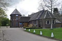 St Mary the Virgin Church, Kinsbourne Green | |
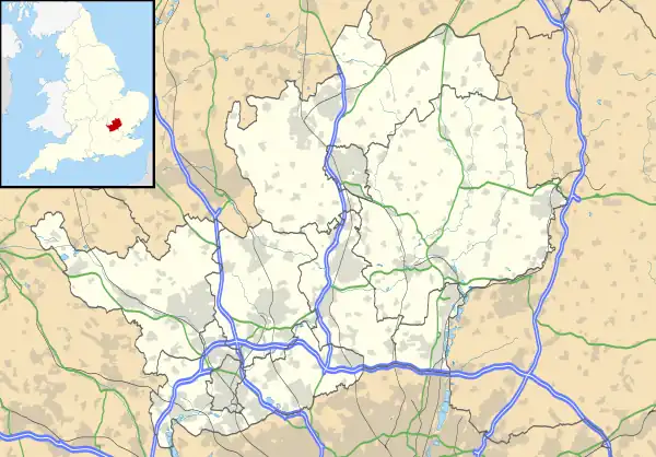 Kinsbourne Green Location within Hertfordshire | |
| District | |
| Shire county | |
| Region | |
| Country | England |
| Sovereign state | United Kingdom |
| Post town | HARPENDEN |
| Postcode district | AL5 |
| Dialling code | 01582 |
| Police | Hertfordshire |
| Fire | Hertfordshire |
| Ambulance | East of England |
| UK Parliament | |
Kinsbourne Green is a small hamlet to the north-west of Harpenden in Hertfordshire, England.[1] The hamlet is now geographically virtually contiguous with Harpenden. Kinsbourne Green is in the civil parish of Harpenden Rural (where at the 2011 Census the population was included).[2]
References
- ↑ Ordnance Survey: Landranger map sheet 166 Luton & Hertford (Hitchin & St Albans) (Map). Ordnance Survey. 2012. ISBN 9780319232095.
- ↑ "Ordnance Survey Election Maps". www.ordnancesurvey.co.uk. Ordnance Survey. Retrieved 3 April 2016.
External links
![]() Media related to Kinsbourne Green at Wikimedia Commons
Media related to Kinsbourne Green at Wikimedia Commons
This article is issued from Wikipedia. The text is licensed under Creative Commons - Attribution - Sharealike. Additional terms may apply for the media files.