Kindu Airport Aéroport de Kindu | |||||||||||
|---|---|---|---|---|---|---|---|---|---|---|---|
 | |||||||||||
| Summary | |||||||||||
| Airport type | Public | ||||||||||
| Operator | Government | ||||||||||
| Serves | Kindu, Democratic Republic of the Congo | ||||||||||
| Elevation AMSL | 1,628 ft / 496 m | ||||||||||
| Coordinates | 02°55′09″S 025°54′55″E / 2.91917°S 25.91528°E | ||||||||||
| Map | |||||||||||
 KND Location in the Democratic Republic of the Congo | |||||||||||
| Runways | |||||||||||
| |||||||||||
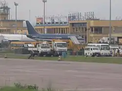
Kindu Airport (IATA: KND, ICAO: FZOA) is an airport serving the Lualaba River port of Kindu, Democratic Republic of the Congo.
The Kindu VOR/DME (Ident: KIN) is located 0.9 nautical miles (1.7 km) west of the airport.[3]
Airlines and destinations
| Airlines | Destinations |
|---|---|
| Compagnie Africaine d'Aviation | Goma, Kinshasa–N'djili, Kisangani |
| Congo Airways | Goma, Kinshasa–N'djili, Kisangani[4] |
See also
References
- ↑ Airport information for Kindu Airport at Great Circle Mapper.
- ↑ "Kindu Airport". Google Maps. Google. Retrieved 21 April 2018.
- ↑ "Kindu VOR (KIN) @ OurAirports". ourairports.com. Retrieved 2018-08-20.
- ↑ "Congo Airways destinations". Congo Airways. Retrieved 21 April 2018.
External links
- Kindu Airport at OpenStreetMap
- Kindu Airport at OurAirports
- Aeronautical chart and airport information for Kindu Airport at SkyVector
- Kindu Airport at FallingRain
- Accident history for Kindu Airport at Aviation Safety Network
This article is issued from Wikipedia. The text is licensed under Creative Commons - Attribution - Sharealike. Additional terms may apply for the media files.