Keshabpur | |
|---|---|
Census Town | |
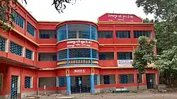 Keshabpur High School | |
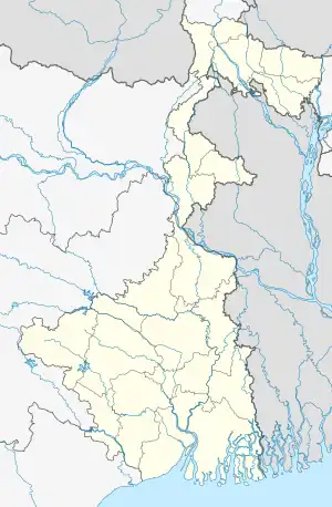 Keshabpur Location in West Bengal, India | |
| Coordinates: 22°37′03″N 88°11′29″E / 22.617417°N 88.191444°E | |
| Country | |
| State | West Bengal |
| District | Howrah |
| Government | |
| • Type | Parliamentary republics |
| Area | |
| • Total | 3 km2 (1 sq mi) |
| Population (2001) | |
| • Total | 5,773 |
| • Density | 1,900/km2 (5,000/sq mi) |
| Languages | |
| • Official | Bengali, English |
| Time zone | UTC+5:30 (IST) |
| Lok Sabha constituency | Sreerampur |
| Vidhan Sabha constituency | Rudrapur |
| Website | howrah |
Keshabpur is a census town under Domjur police station in Sadar subdivision of Howrah district in the Indian state of West Bengal.[1][2]
Geography
Keshabpur is located at 22°37′02.7″N 88°11′29.2″E / 22.617417°N 88.191444°E
References
- ↑ "District-wise list of stautory towns". Census Commission of India. Archived from the original on 25 April 2009. Retrieved 28 January 2009.
- ↑ "Archived copy". www.censusindia.net. Archived from the original on 16 June 2004. Retrieved 12 January 2022.
{{cite web}}: CS1 maint: archived copy as title (link)
| Cities, municipal and census towns | |
|---|---|
| Locations other than cities and towns | |
| Villages | |
| Related topics |
|
- ↑ https://www.facebook.com/keshabpurhighschool
- ↑ https://www.facebook.com/keshabpurpalpara
- ↑ "Home". hy-club.webs.com.
This article is issued from Wikipedia. The text is licensed under Creative Commons - Attribution - Sharealike. Additional terms may apply for the media files.