Kenli
垦利区 | |
|---|---|
 Yellow River mouth | |
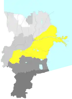 Location in Dongying | |
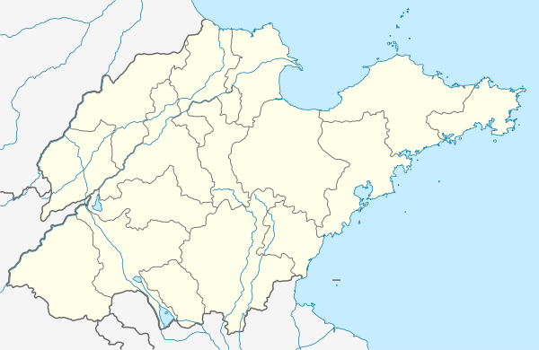 Kenli Location in Shandong | |
| Coordinates: 37°34′19″N 118°34′30″E / 37.572°N 118.575°E | |
| Country | People's Republic of China |
| Province | Shandong |
| Prefecture-level city | Dongying |
| Area | |
| • Total | 2,331 km2 (900 sq mi) |
| Elevation | 7.6 m (25 ft) |
| Population (2019) | |
| • Total | 238,900[1] |
| Time zone | UTC+8 (China Standard) |
| Postal code | 257500 |
| Website | www |
Kenli District (simplified Chinese: 垦利区; traditional Chinese: 墾利區; pinyin: Kěnlì Qū) is a district of the city of Dongying, in northern Shandong province. The district includes the mouth of the Yellow River.[2] As of 2019, Kenli District has a population of 238,900.[3]
History
Geography
The mouth of the Yellow River is located in Kenli District, and flows through the district for 118 kilometres (73 mi).[2] Other major rivers in the district include the Xiaodao River (Chinese: 小岛河), the Yongfeng River (Chinese: 永丰河), the Yihong River (Chinese: 溢洪河), and the Guangli River.[2]
Climate
The average annual temperature is 12.3 °C (54.1 °F), and the average annual precipitation is 538.4 millimetres (21.20 in).[5]
| Climate data for Kenli (1991–2020 normals, extremes 1981–2010) | |||||||||||||
|---|---|---|---|---|---|---|---|---|---|---|---|---|---|
| Month | Jan | Feb | Mar | Apr | May | Jun | Jul | Aug | Sep | Oct | Nov | Dec | Year |
| Record high °C (°F) | 17.2 (63.0) |
22.6 (72.7) |
30.3 (86.5) |
33.8 (92.8) |
39.2 (102.6) |
40.5 (104.9) |
39.1 (102.4) |
37.0 (98.6) |
35.6 (96.1) |
31.4 (88.5) |
25.6 (78.1) |
19.7 (67.5) |
40.5 (104.9) |
| Mean daily maximum °C (°F) | 3.0 (37.4) |
6.5 (43.7) |
13.2 (55.8) |
20.7 (69.3) |
26.6 (79.9) |
30.4 (86.7) |
31.8 (89.2) |
30.6 (87.1) |
27.1 (80.8) |
20.7 (69.3) |
12.2 (54.0) |
5.0 (41.0) |
19.0 (66.2) |
| Daily mean °C (°F) | −1.9 (28.6) |
1.1 (34.0) |
7.2 (45.0) |
14.4 (57.9) |
20.7 (69.3) |
25.0 (77.0) |
27.3 (81.1) |
26.3 (79.3) |
22 (72) |
15.1 (59.2) |
7.1 (44.8) |
0.3 (32.5) |
13.7 (56.7) |
| Mean daily minimum °C (°F) | −5.3 (22.5) |
−2.7 (27.1) |
2.5 (36.5) |
9.2 (48.6) |
15.4 (59.7) |
20.2 (68.4) |
23.5 (74.3) |
22.9 (73.2) |
17.8 (64.0) |
10.7 (51.3) |
3.2 (37.8) |
−3.1 (26.4) |
9.5 (49.1) |
| Record low °C (°F) | −15.6 (3.9) |
−13.2 (8.2) |
−7.4 (18.7) |
−1.3 (29.7) |
4.7 (40.5) |
10.6 (51.1) |
17.1 (62.8) |
14.8 (58.6) |
6.7 (44.1) |
−0.9 (30.4) |
−9.2 (15.4) |
−15.6 (3.9) |
−15.6 (3.9) |
| Average precipitation mm (inches) | 4.6 (0.18) |
9.4 (0.37) |
8.3 (0.33) |
23.5 (0.93) |
46.3 (1.82) |
82.4 (3.24) |
171.9 (6.77) |
145.6 (5.73) |
36.1 (1.42) |
27.1 (1.07) |
20.1 (0.79) |
5.7 (0.22) |
581 (22.87) |
| Average precipitation days (≥ 0.1 mm) | 2.1 | 2.8 | 3.1 | 5.4 | 5.9 | 7.6 | 10.9 | 9.8 | 5.7 | 5.0 | 3.8 | 2.5 | 64.6 |
| Average snowy days | 3.3 | 3.1 | 1.1 | 0.1 | 0 | 0 | 0 | 0 | 0 | 0 | 0.7 | 2.4 | 10.7 |
| Average relative humidity (%) | 61 | 58 | 52 | 52 | 56 | 63 | 74 | 77 | 69 | 65 | 64 | 62 | 63 |
| Mean monthly sunshine hours | 181.8 | 182.0 | 231.7 | 248.1 | 276.6 | 252.4 | 216.3 | 215.4 | 216.9 | 208.0 | 172.7 | 171.1 | 2,573 |
| Percent possible sunshine | 59 | 59 | 62 | 62 | 63 | 57 | 49 | 52 | 59 | 61 | 57 | 58 | 58 |
| Source: China Meteorological Administration[6][7] | |||||||||||||
Administrative divisions
As of 2020, Kenli District is divided into 2 subdistricts, 5 towns, and 4 township-level equivalents.[8]
Subdistricts
Towns
Demographics
According to Harvard University's China Historical GIS, Kenli had a population of 211,444 in 1999.[5]
In the 2000 Chinese Census, Kenli had a recorded population of 242,654.[4]
Transportation
Air
Dongying Shengli Airport is located in the southeast of Kenli District.[2]
Rail
The Zibo–Dongying railway passes through the district.[2]
References
- ↑ "China : Population - ceicdata.com". ceicdata. Retrieved 2021-01-05.
- 1 2 3 4 5 垦利区概况地图 [Kenli District Overview]. xzqh.org (in Chinese). 2016-07-15. Archived from the original on 2019-07-03. Retrieved 2021-03-20.
- ↑ "China : Population - ceicdata.com". ceicdata. Retrieved 2021-01-05.
- 1 2 3 垦利区历史沿革 [Kenli District Organizational History]. xzqh.org (in Chinese). 2016-07-15. Archived from the original on 2019-07-03. Retrieved 2021-03-20.
- 1 2 National Population Statistics Materials by County and City - 1999 Period, in China County & City Population 1999, Harvard China Historical GIS
- ↑ 中国气象数据网 – WeatherBk Data (in Simplified Chinese). China Meteorological Administration. Retrieved 12 August 2023.
- ↑ 中国气象数据网 (in Simplified Chinese). China Meteorological Administration. Retrieved 12 August 2023.
- ↑ 2020年统计用区划代码(垦利区) [2020 Statistical Division Codes (Kenli District)] (in Chinese). National Bureau of Statistics of China. 2020. Archived from the original on 2021-03-20. Retrieved 2021-03-20.