| Kellalac Victoria | |||||||||
|---|---|---|---|---|---|---|---|---|---|
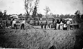 Kellalac farm c. 1885 | |||||||||
 Kellalac | |||||||||
| Coordinates | 36°22′56″S 142°24′00″E / 36.3822014°S 142.3999124°E | ||||||||
| Population | 17 [1] (2016 census) | ||||||||
| Postcode(s) | 3393 | ||||||||
| Elevation | 121[2] m (397 ft) | ||||||||
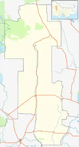
| Location |
| ||||||||
| LGA(s) | Shire of Yarriambiack | ||||||||
| State electorate(s) | Lowan | ||||||||
| Federal division(s) | Mallee | ||||||||
| |||||||||
Kellalac is a locality near Warracknabeal in Victoria, Australia. Kellalac has a bushland reserve.[3] The locality has a joint cricket team with Brim and Sheep Hills.[4]
References
- ↑ "2016 Kellalac, Census All persons QuickStats | Australian Bureau of Statistics". abs.gov.au. Retrieved 25 May 2022.
- ↑ "Kellalac climate, averages and extreme weather record - Meat & Livestock Australia".
- ↑ Victoria, Parks. "Kellalac Bushland Reserve". parkweb.vic.gov.au. Retrieved 19 June 2016.
- ↑ "BKSHCC: Home". cricket.com.au. Retrieved 19 June 2016.
Localities in the Shire of Yarriambiack | ||
|---|---|---|
| Town | | |
| Locality | ||
^ - Territory divided with another LGA | ||
This article is issued from Wikipedia. The text is licensed under Creative Commons - Attribution - Sharealike. Additional terms may apply for the media files.