| Jaman-Too | |
|---|---|
 Jaman-Too | |
| Highest point | |
| Elevation | 4,737 m (15,541 ft) |
| Coordinates | 40°55′48.47″N 74°52′24.66″E / 40.9301306°N 74.8735167°E |
| Dimensions | |
| Length | 110 km (68 mi) E-W |
| Width | 16 km (9.9 mi) N-S |
| Naming | |
| Native name | |
| Geography | |
| Country | Kyrgyzstan |
| Region | Naryn Region |
| District | At-Bashy District |
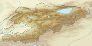
The Jaman-Too (Kyrgyz: Жаман-Тоо, Kyrgyz: Жамантоо, or Russian: Джаман-Тау, and also known as Arpanyn Ala-Toosuu) is a range in the south-west of the Internal Tien-Shan. In the east, the range adjoins Fergana Range. It stretches for a length of 110 km (68 mi) with a width of 16 km (9.9 mi). The average elevation is approximately 4,000 m (13,000 ft), and the highest elevation of 4,737 m (15,541 ft). The southern slopes are steep, and northern - gentle. The mountains are composed of limestone, sandstone, and dolomite. [1]
References
This article is issued from Wikipedia. The text is licensed under Creative Commons - Attribution - Sharealike. Additional terms may apply for the media files.