Iúna | |
|---|---|
Municipality | |
.jpg.webp) Flag  Seal | |
 | |
 Iúna | |
| Coordinates: 20°20′45″S 41°32′09″W / 20.34583°S 41.53583°W | |
| Country | Brazil |
| State | Espírito Santo |
| Established | 11 November 1890 |
| Area | |
| • Total | 461 km2 (178 sq mi) |
| Elevation | 670 m (2,200 ft) |
| Population (2020 [2]) | |
| • Total | 29,290 |
| • Summer (DST) | UTC−3 (BRT) |
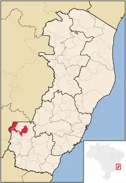
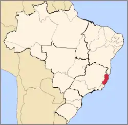
Iúna is a municipality located in the Brazilian state of Espírito Santo. Its population was 29,290 (2020) and its area is 461 km2 (178 sq mi).[1]
References
Capital: Vitória | ||||||||||
| Mesoregion Central |
|  | ||||||||
| Mesoregion Litoral Norte |
| |||||||||
| Mesoregion Noroeste |
| |||||||||
| Mesoregion Sul |
| |||||||||
This article is issued from Wikipedia. The text is licensed under Creative Commons - Attribution - Sharealike. Additional terms may apply for the media files.