Hostěnice | |
|---|---|
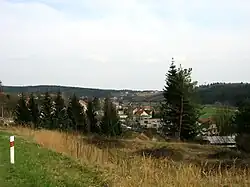 View towards Hostěnice | |
 Flag  Coat of arms | |
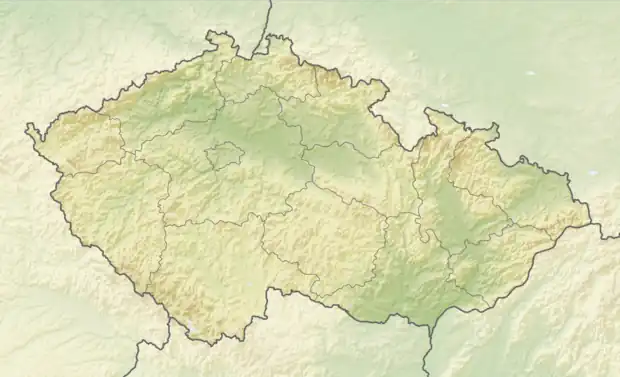 Hostěnice Location in the Czech Republic | |
| Coordinates: 49°14′12″N 16°46′36″E / 49.23667°N 16.77667°E | |
| Country | |
| Region | South Moravian |
| District | Brno-Country |
| First mentioned | 1371 |
| Area | |
| • Total | 19.99 km2 (7.72 sq mi) |
| Elevation | 396 m (1,299 ft) |
| Population (2023-01-01)[1] | |
| • Total | 827 |
| • Density | 41/km2 (110/sq mi) |
| Time zone | UTC+1 (CET) |
| • Summer (DST) | UTC+2 (CEST) |
| Postal codes | 664 04 |
| Website | www |
Hostěnice is a municipality and village in Brno-Country District in the South Moravian Region of the Czech Republic. It has about 800 inhabitants.
Hostěnice lies approximately 14 kilometres (9 mi) north-east of Brno and 195 km (121 mi) south-east of Prague.
Administrative parts
The village of Lhotky is an administrative part of Hostěnice.
Demographics
| Year | Pop. | ±% |
|---|---|---|
| 1869 | 435 | — |
| 1880 | 510 | +17.2% |
| 1890 | 534 | +4.7% |
| 1900 | 560 | +4.9% |
| 1910 | 657 | +17.3% |
| 1921 | 596 | −9.3% |
| 1930 | 598 | +0.3% |
| 1950 | 539 | −9.9% |
| 1961 | 590 | +9.5% |
| 1970 | 534 | −9.5% |
| 1980 | 510 | −4.5% |
| 1991 | 457 | −10.4% |
| 2001 | 450 | −1.5% |
| 2011 | 644 | +43.1% |
| 2021 | 841 | +30.6% |
| Source: Censuses[2][3] | ||
References
- ↑ "Population of Municipalities – 1 January 2023". Czech Statistical Office. 2023-05-23.
- ↑ "Historický lexikon obcí České republiky 1869–2011 – Okres Brno-venkov" (in Czech). Czech Statistical Office. 2015-12-21.
- ↑ "Population Census 2021: Population by sex". Public Database. Czech Statistical Office. 2021-03-27.
Wikimedia Commons has media related to Hostěnice.
This article is issued from Wikipedia. The text is licensed under Creative Commons - Attribution - Sharealike. Additional terms may apply for the media files.