Hmawbi
မှော်ဘီ | |
|---|---|
 Hmawbi | |
 Hmawbi Hmawbi Township in Yangon Region, MM
subdivision_name = | |
| Coordinates (Township in Yangon Region): 17°06′03″N 96°02′25″E / 17.10083°N 96.04028°E | |
| Country | Myanmar |
| Region | |
| Township | Hmawbi |
| Area | |
| • Township, City, District | 47 km2 (18 sq mi) |
| Population (2014)[1] | |
| • Urban | more than 400k |
| Time zone | UTC+06:30 (Myanmar Standard Time or Asia/Yangon) |
| Area Code | +951 |
| Geocode | Hmawbi Township |
| ISO 3166 code | mm |
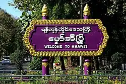
Hmawbi (Burmese: မှော်ဘီ) is a township in the Yangon Region. It is located northwest of the city of Yangon. The principal town and administrative seat is Hmawbi.[2]
The Hmawbi airport is at Indan, 4 kilometres (2.5 mi) northeast of the town of Hmawbi.[3]
Borders
The Hlaing River forms the western border of Hmawbi Township, which borders on:
- Taikkyi Township to the north;
- Hlegu Township to the east;
- Mingaladon Township to the southeast;
- Shwepyitha Township to the south; and
- Htantabin Township to the southwest, west and northwest.
Climate
| Climate data for Hmawbi (1991–2020) | |||||||||||||
|---|---|---|---|---|---|---|---|---|---|---|---|---|---|
| Month | Jan | Feb | Mar | Apr | May | Jun | Jul | Aug | Sep | Oct | Nov | Dec | Year |
| Mean daily maximum °C (°F) | 32.8 (91.0) |
35.0 (95.0) |
37.0 (98.6) |
38.0 (100.4) |
34.6 (94.3) |
31.0 (87.8) |
30.3 (86.5) |
30.1 (86.2) |
31.2 (88.2) |
32.7 (90.9) |
33.5 (92.3) |
32.4 (90.3) |
33.2 (91.8) |
| Daily mean °C (°F) | 24.3 (75.7) |
26.1 (79.0) |
28.7 (83.7) |
30.8 (87.4) |
29.6 (85.3) |
27.7 (81.9) |
27.2 (81.0) |
27.1 (80.8) |
27.6 (81.7) |
28.1 (82.6) |
27.3 (81.1) |
25.0 (77.0) |
27.5 (81.5) |
| Mean daily minimum °C (°F) | 15.9 (60.6) |
17.2 (63.0) |
20.5 (68.9) |
23.5 (74.3) |
24.5 (76.1) |
24.3 (75.7) |
24.1 (75.4) |
24.0 (75.2) |
24.0 (75.2) |
23.5 (74.3) |
21.2 (70.2) |
17.5 (63.5) |
21.7 (71.1) |
| Average precipitation mm (inches) | 6.3 (0.25) |
3.7 (0.15) |
11.0 (0.43) |
28.6 (1.13) |
275.2 (10.83) |
502.1 (19.77) |
570.7 (22.47) |
527.1 (20.75) |
371.8 (14.64) |
164.9 (6.49) |
51.4 (2.02) |
5.2 (0.20) |
2,518 (99.1) |
| Average precipitation days (≥ 1.0 mm) | 0.5 | 0.4 | 0.8 | 1.8 | 13.5 | 24.7 | 26.2 | 25.7 | 21.4 | 11.9 | 2.9 | 0.4 | 130.2 |
| Source: World Meteorological Organization[4] | |||||||||||||
Notes
- ↑ http://www.mapnall.com/en/Map-Hmawbi_1574528.html
- ↑ "Hmawbi, MM Current Local Time, Time Zone, Hourly Weather and Weather History". cityclock.org. Retrieved 2024-01-12.
- ↑ "Wayback Machine" (PDF). 2023-02-09. Archived from the original (PDF) on 2023-02-09. Retrieved 2023-02-09.
- ↑ "World Meteorological Organization Climate Normals for 1991–2020". World Meteorological Organization. Retrieved 16 October 2023.
External links
Wikimedia Commons has media related to Hmawbi.
Capital: Yangon | ||
| East Yangon District |  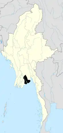 | |
| North Yangon District | ||
| South Yangon District | ||
| West Yangon District (Downtown) | ||
| Main cities and towns | ||
1 - part of South Yangon City; 2 - part of North Yangon City | ||
- "Hmawbi Township, Yangon Region" map ID: MIMU154 Hmawbi Township 090227 v01, February 2009, Myanmar Information Management Unit (MIMU)
- Technological University exists in Hmawbi Township also Aung Zabu Monastery[1] Operating licenses for steel smelters that do not relocate to the Industrial Zone are not renewed.
- ↑ "Myaung Dagar Industrial Zone 80pc done". Myanmar Times. 25 February 2008. Archived from the original on 25 January 2013. Retrieved 5 March 2012.
This article is issued from Wikipedia. The text is licensed under Creative Commons - Attribution - Sharealike. Additional terms may apply for the media files.