Hautmougey | |
|---|---|
Part of La Vôge-les-Bains | |
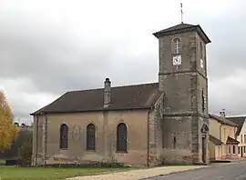 The church in Hautmougey | |
Location of Hautmougey | |
 Hautmougey 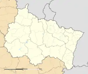 Hautmougey | |
| Coordinates: 48°01′45″N 6°14′00″E / 48.0292°N 6.2333°E | |
| Country | France |
| Region | Grand Est |
| Department | Vosges |
| Arrondissement | Épinal |
| Canton | Le Val-d'Ajol |
| Commune | La Vôge-les-Bains |
| Area 1 | 7.87 km2 (3.04 sq mi) |
| Population (2019)[1] | 126 |
| • Density | 16/km2 (41/sq mi) |
| Time zone | UTC+01:00 (CET) |
| • Summer (DST) | UTC+02:00 (CEST) |
| Postal code | 88240 |
| Elevation | 272–405 m (892–1,329 ft) (avg. 332 m or 1,089 ft) |
| 1 French Land Register data, which excludes lakes, ponds, glaciers > 1 km2 (0.386 sq mi or 247 acres) and river estuaries. | |
Hautmougey (French pronunciation: [omuʒɛ] ⓘ) is a former commune in the Vosges department in Grand Est in northeastern France. On 1 January 2017, it was merged into the new commune La Vôge-les-Bains.[2]
Geography
The Côney forms the commune's eastern border.
See also
References
- ↑ Téléchargement du fichier d'ensemble des populations légales en 2019, INSEE
- ↑ Arrêté préfectoral 5 December 2016 (in French)
Wikimedia Commons has media related to Hautmougey.
This article is issued from Wikipedia. The text is licensed under Creative Commons - Attribution - Sharealike. Additional terms may apply for the media files.