Hasborn-Dautweiler | |
|---|---|
 Coat of arms | |
Location of Hasborn-Dautweiler | |
 Hasborn-Dautweiler 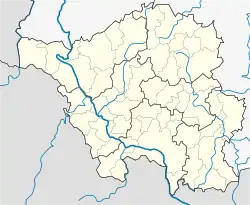 Hasborn-Dautweiler | |
| Coordinates: 49°28′N 7°2′E / 49.467°N 7.033°E | |
| Country | Germany |
| State | Saarland |
| District | Sankt Wendel |
| Municipality | Tholey |
| Area | |
| • Total | 9.04 km2 (3.49 sq mi) |
| Elevation | 339 m (1,112 ft) |
| Population (2020) | |
| • Total | 2,589 |
| • Density | 290/km2 (740/sq mi) |
| Time zone | UTC+01:00 (CET) |
| • Summer (DST) | UTC+02:00 (CEST) |
| Postal codes | 66636 |
| Dialling codes | 06853 |
| Vehicle registration | WND |

The old town hall of Hasborn-Dautweiler
Hasborn-Dautweiler is a part of the municipality Tholey in the district of Sankt Wendel in the northern Saarland, Germany. Until the end of 1973 Hasborn-Dautweiler was an independent municipality.
History
In connection with the territory and administrative reform in the Saarland in 1974, on January 1, 1974, the thus far independent municipality Hasborn-Dautweiler was associated to the newly created municipality of Tholey [1]

References
- ↑ Neugliederungsgesetz – NGG vom 19. Dezember 1973, § 37, veröffentlicht im Amtsblatt des Saarlandes 1973, Nr. 48, S. 857 (PDF Seite 29; 499 kB)
This article is issued from Wikipedia. The text is licensed under Creative Commons - Attribution - Sharealike. Additional terms may apply for the media files.