Halba
حلبا | |
|---|---|
Town | |
| Halba | |
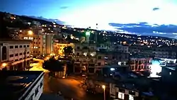 Halba at night | |
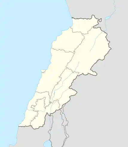 Halba Location within Lebanon | |
| Coordinates: 34°33′2″N 36°4′41″E / 34.55056°N 36.07806°E | |
| Country | |
| Governorate | Akkar Governorate |
| District | Akkar District |
| Elevation | 167 m (548 ft) |
| Population (2013) | |
| • Total | 4,730 eligible voters |
| Time zone | UTC+2 (EET) |
| • Summer (DST) | UTC+3 (EEST) |
| Dialing code | +961 |
Halba (Arabic: حلبا) is the capital of Akkar Governorate in northern Lebanon, close to the border with Syria. It is located at around 34°33′2″N 36°4′41″E / 34.55056°N 36.07806°E. Its population is divided between Sunni Muslim, Greek Orthodox Christians, Maronites, and followers of other religions.[1]
History
In 1838, Eli Smith noted the village, whose inhabitants were Greek Orthodox, located west of esh-Sheikh Mohammed.[2]
In 1856 it was named Halba on Kiepert's map of Palestine/Lebanon published that year,[3]
Halba is home to Sada Akkar Newspaper, the only privately owned news agency in Akkar District. Halba is also home to a Lebanese Red Cross First Aid Center. Today, it is majority Sunni Muslim.
References
- ↑ "Municipal and ikhtiyariah elections in Northern Lebanon" (PDF). The Monthly. March 2010. p. 21. Archived from the original on 3 June 2016. Retrieved 4 November 2016.
{{cite web}}: CS1 maint: bot: original URL status unknown (link) - ↑ Robinson and Smith, 1841, vol 3, 2nd appendix, p. 183
- ↑ Kiepert, 1856, Map of Northern Palestine/Lebanon
Bibliography
External links
- Halba Archived 2017-02-09 at the Wayback Machine, Localiban
- Halba news section on Sada Akkar newspaper
Capital: Halba | ||||||||||||||||
| Villages |
|  | ||||||||||||||
This article is issued from Wikipedia. The text is licensed under Creative Commons - Attribution - Sharealike. Additional terms may apply for the media files.