Höchheim | |
|---|---|
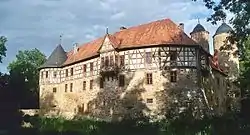 Irmelshausen Castle | |
 Coat of arms | |
Location of Höchheim within Rhön-Grabfeld district 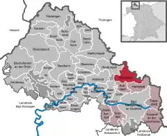 | |
 Höchheim  Höchheim | |
| Coordinates: 50°22′N 10°27′E / 50.367°N 10.450°E | |
| Country | Germany |
| State | Bavaria |
| Admin. region | Unterfranken |
| District | Rhön-Grabfeld |
| Municipal assoc. | Bad Königshofen im Grabfeld |
| Government | |
| • Mayor (2020–26) | Michael Hey[1] |
| Area | |
| • Total | 25.25 km2 (9.75 sq mi) |
| Elevation | 296 m (971 ft) |
| Population (2022-12-31)[2] | |
| • Total | 1,072 |
| • Density | 42/km2 (110/sq mi) |
| Time zone | UTC+01:00 (CET) |
| • Summer (DST) | UTC+02:00 (CEST) |
| Postal codes | 97633 |
| Dialling codes | 09764 |
| Vehicle registration | NES |
| Website | hoechheim |
Höchheim is a municipality in the district of Rhön-Grabfeld in Bavaria in Germany. Höchheim consists of the following villages: Gollmuthhausen, Höchheim, Irmelshausen, Rothausen.
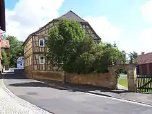
Former Bibra. Manor House
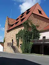
Bibra Customs House
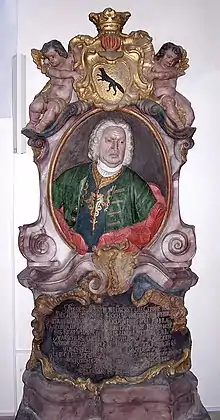
Friedrich Kaspar von Bibra (1681–1750)
References
- ↑ Liste der ersten Bürgermeister/Oberbürgermeister in kreisangehörigen Gemeinden, Bayerisches Landesamt für Statistik, 15 July 2021.
- ↑ Genesis Online-Datenbank des Bayerischen Landesamtes für Statistik Tabelle 12411-003r Fortschreibung des Bevölkerungsstandes: Gemeinden, Stichtag (Einwohnerzahlen auf Grundlage des Zensus 2011)
Wikimedia Commons has media related to Höchheim.
This article is issued from Wikipedia. The text is licensed under Creative Commons - Attribution - Sharealike. Additional terms may apply for the media files.