Grayridge, Missouri | |
|---|---|
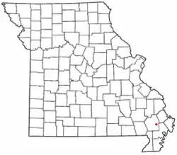 Location of Grayridge in Missouri | |
| Coordinates: 36°49′29″N 89°46′55″W / 36.82472°N 89.78194°W | |
| Country | United States |
| State | Missouri |
| County | Stoddard |
| Area | |
| • Total | 1.02 sq mi (2.64 km2) |
| • Land | 1.02 sq mi (2.64 km2) |
| • Water | 0.00 sq mi (0.00 km2) |
| Elevation | 299 ft (91 m) |
| Population (2020) | |
| • Total | 87 |
| • Density | 85.46/sq mi (32.99/km2) |
| FIPS code | 29-28864 |
| GNIS feature ID | 2587076[2] |
Grayridge is a census-designated place in eastern Stoddard County, Missouri, United States.[2] It is located approximately ten miles southwest of Sikeston, just south of U.S. Route 60.[3]
A post office called Gray's Ridge was established in 1879, the name was changed to Gray Ridge in 1887, and the present name of Grayridge was adopted in 1894.[4] The community has the name of W. C. Gray, a pioneer citizen.[5]
Grayridge is home to Stoddard County Oilseed Crushing, which is developing biodiesel.[6]
Demographics
| Census | Pop. | Note | %± |
|---|---|---|---|
| 2020 | 87 | — | |
| U.S. Decennial Census[7] | |||
References
- ↑ "ArcGIS REST Services Directory". United States Census Bureau. Retrieved September 5, 2022.
- 1 2 3 U.S. Geological Survey Geographic Names Information System: Grayridge, Missouri
- ↑ Missouri Hometown Locator http://missouri.hometownlocator.com/mo/stoddard/grayridge.cfm
- ↑ "Post Offices". Jim Forte Postal History. Retrieved December 26, 2016.
- ↑ "Stoddard County Place Names, 1928–1945". The State Historical Society of Missouri. Archived from the original on June 24, 2016. Retrieved December 26, 2016.
- ↑ Standard Democrat http://www.standard-democrat.com/story/1678861.html
- ↑ "Census of Population and Housing". Census.gov. Retrieved June 4, 2016.
Municipalities and communities of Stoddard County, Missouri, United States | ||
|---|---|---|
| Cities | 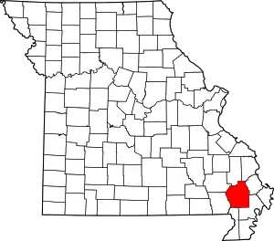 Map of Missouri highlighting Stoddard County | |
| Villages | ||
| Townships | ||
| CDP | ||
| Other unincorporated communities | ||
| Ghost towns | ||
This article is issued from Wikipedia. The text is licensed under Creative Commons - Attribution - Sharealike. Additional terms may apply for the media files.