Grabersdorf | |
|---|---|
 | |
 Coat of arms | |
 Grabersdorf Location within Austria | |
| Coordinates: 46°51′00″N 15°49′00″E / 46.85000°N 15.81667°E | |
| Country | Austria |
| State | Styria |
| District | Südoststeiermark |
| Government | |
| • Mayor | Franz Kazianschütz (ÖVP) |
| Area | |
| • Total | 6.37 km2 (2.46 sq mi) |
| Elevation | 267 m (876 ft) |
| Population (1 January 2016)[1] | |
| • Total | 351 |
| • Density | 55/km2 (140/sq mi) |
| Time zone | UTC+1 (CET) |
| • Summer (DST) | UTC+2 (CEST) |
| Postal code | 8342 |
| Area code | +43 3151 |
| Vehicle registration | FB |
| Website | www.grabersdorf. steiermark.at |
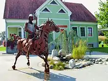
Iron Knight of Grabersdorf before the Municipal House
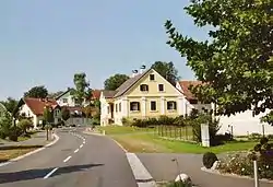
Grabersdorf is a former municipality in the district of Südoststeiermark in the Austrian state of Styria. Since the 2015 Styria municipal structural reform, it is part of the municipality Gnas.[2]
Population
| Year | Pop. | ±% |
|---|---|---|
| 1869 | 470 | — |
| 1880 | 445 | −5.3% |
| 1890 | 435 | −2.2% |
| 1900 | 409 | −6.0% |
| 1910 | 386 | −5.6% |
| 1923 | 382 | −1.0% |
| 1934 | 387 | +1.3% |
| 1939 | 372 | −3.9% |
| 1951 | 350 | −5.9% |
| 1961 | 342 | −2.3% |
| 1971 | 375 | +9.6% |
| 1981 | 404 | +7.7% |
| 1991 | 360 | −10.9% |
| 2001 | 373 | +3.6% |
| 2013 | 342 | −8.3% |
References
This article is issued from Wikipedia. The text is licensed under Creative Commons - Attribution - Sharealike. Additional terms may apply for the media files.