Glojach | |
|---|---|
 Glojach | |
 Coat of arms | |
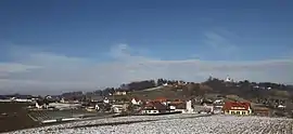
 Glojach Location within Austria | |
| Coordinates: 46°52′00″N 15°41′00″E / 46.86667°N 15.68333°E | |
| Country | Austria |
| State | Styria |
| District | Südoststeiermark |
| Government | |
| • Mayor | Karl Trummer (ÖVP) |
| Area | |
| • Total | 3.38 km2 (1.31 sq mi) |
| Elevation | 410 m (1,350 ft) |
| Population (1 January 2016)[1] | |
| • Total | 245 |
| • Density | 72/km2 (190/sq mi) |
| Time zone | UTC+1 (CET) |
| • Summer (DST) | UTC+2 (CEST) |
| Postal code | 8421 |
| Area code | +43 3184 |
| Vehicle registration | FB |
| Website | www.glojach. steiermark.at |
Glojach is a former municipality in the district of Südoststeiermark in the Austrian state of Styria. Since the 2015 Styria municipal structural reform, it is part of the municipality Sankt Stefan im Rosental.[2]
Population
| Year | Pop. | ±% |
|---|---|---|
| 1869 | 317 | — |
| 1880 | 271 | −14.5% |
| 1890 | 284 | +4.8% |
| 1900 | 291 | +2.5% |
| 1910 | 323 | +11.0% |
| 1923 | 286 | −11.5% |
| 1934 | 282 | −1.4% |
| 1939 | 284 | +0.7% |
| 1951 | 242 | −14.8% |
| 1961 | 236 | −2.5% |
| 1971 | 241 | +2.1% |
| 1981 | 233 | −3.3% |
| 1991 | 237 | +1.7% |
| 2001 | 238 | +0.4% |
| 2013 | 244 | +2.5% |
References
- ↑ Statistik Austria - Bevölkerung zu Jahresbeginn 2002-2016 nach Gemeinden (Gebietsstand 1.1.2016) for Glojach.
- ↑ "Die neue Gemeindestruktur der Steiermark" (PDF). Gemeindestrukturreform.steiermark.at. Retrieved 2 November 2018.
This article is issued from Wikipedia. The text is licensed under Creative Commons - Attribution - Sharealike. Additional terms may apply for the media files.