| Glazov Glacier ледник Глазов | |
|---|---|
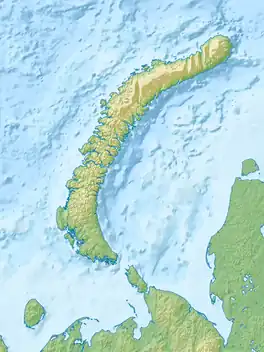 Glazov Glacier ледник Глазов Location within Novaya Zemlya, Russia | |
| Type | Tidewater glacier |
| Location | Novaya Zemlya Russian Federation |
| Coordinates | 75°9′N 57°24′E / 75.150°N 57.400°E |
| Length | 30 km |
| Width | 3.5 km |
| Terminus | Glazov Bay Barents Sea |
The Glazov Glacier (Russian: ледник Глазов; lednik Glazov) is a glacier in Novaya Zemlya, Arkhangelsk Oblast, Russia.[1]
The Glazov glacier has retreated between 2 kilometres (1.2 mi) and 3 kilometres (1.9 mi) in recent years. Two new islands and two headlands have been exposed in the area of the mouth of the fjord as a result.[2]
Geography
The Glazov Glacier is located on the western side of northern Severny Island of Novaya Zemlya. It is a tidewater glacier flowing from the Severny Island ice cap in a roughly southeast–northwest direction. Its terminus is at Glazov Bay, a 5 kilometres (3.1 mi) wide fjord located just south of Nordenskiöld Bay in the Barents Sea.[3]
1,547 metres (5,075 ft) high Mount Kruzenshtern, the highest point of Novaya Zemlya, rises on the northern side of the head of the Glazov Glacier.[4]
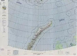 Map of northern Novaya Zemlya and southern Franz Josef Land. |
See also
Further reading
- J. J. Zeeberg, Climate and Glacial History of the Novaya Zemlya Archipelago, Russian Arctic. Purdue University Press (January 1, 2002) ISBN 978-9051705638
References
- ↑ "Ледник Глазов". Wikimapia. Retrieved 16 December 2021.
- ↑ Поход гидрографического судна «Сенеж» Северного флота к высоким широтам позволил открыть 9 островов и 5 проливов
- ↑ GoogleEarth
- ↑ Google Maps
External links
- Changes in glacier extent on north Novaya Zemlya
- Hydrographers of the Northern Fleet in 2015 filled in the "blank spots" on the Arctic map (in Russian)