| Gallo Peak | |
|---|---|
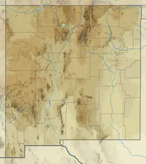 Gallo Peak Torrance County, New Mexico, United States  Gallo Peak Gallo Peak (the United States) | |
| Highest point | |
| Elevation | 10,010 ft (3,050 m)[1] |
| Prominence | 323 ft (98 m)[2] |
| Isolation | 0.87 mi (1.40 km) to Peak 10057[2] |
| Coordinates | 34°38′14″N 106°26′19″W / 34.63722°N 106.43861°W[1] |
| Geography | |
| Location | Torrance County, New Mexico, United States |
| Parent range | Manzano Mountains[3] |
| Topo map | USGS Capilla Peak |
| Geology | |
| Type of rock | Sais Quartzite[4] |
| Climbing | |
| Easiest route | Hiking, Open Country |
Gallo Peak is located in the Manzano Mountains in Torrance County, New Mexico.[5] Gallo Peak is in Cibola National Forest, and is ranked the 222nd highest peak in New Mexico.[5][6]
Gallo Peak is 5 miles (8 km) due west of the town Manzano and can be accessed via the Red Canyon Road, then onto the Canyon and Crest trails.[5]
References
- 1 2 "Gallo Peak". Geographic Names Information System. United States Geological Survey, United States Department of the Interior. January 1, 1980. Retrieved April 13, 2023.
- 1 2 "Gallo Peak, New Mexico". Peakbagger.com. Retrieved 13 April 2023.
- ↑ "Manzano Mountains". Peakbagger.com. Retrieved 13 April 2023.
- ↑ "Geology of the Capilla Peak 7.5-minute quadrangle, Valencia and Torrance Counties, New Mexico". New Mexico Bureau of Mines and Mineral Resources. 2001. Retrieved April 13, 2023.
- 1 2 3 "topoView". National Geologic Map Database project (NGMDB). Retrieved 13 April 2023.
- ↑ "Gallo Peak NM". Retrieved 13 April 2023.
This article is issued from Wikipedia. The text is licensed under Creative Commons - Attribution - Sharealike. Additional terms may apply for the media files.