| Galley Run Tributary to Youghiogheny River | |
|---|---|
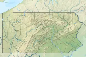 Location of Galley Run mouth  Galley Run (the United States) | |
| Location | |
| Country | United States |
| State | Pennsylvania |
| County | Fayette |
| Physical characteristics | |
| Source | Jacobs Creek divide |
| • location | about 0.5 miles west of Owensdale, Pennsylvania[1] |
| • coordinates | 40°04′48″N 079°37′08″W / 40.08000°N 79.61889°W[2] |
| • elevation | 1,075 ft (328 m)[1] |
| Mouth | Youghiogheny River |
• location | Broad Ford, Pennsylvania[3] |
• coordinates | 40°02′49″N 079°36′42″W / 40.04694°N 79.61167°W[2] |
• elevation | 852 ft (260 m)[3] |
| Length | 2.91 mi (4.68 km)[4] |
| Basin size | 3.51 square miles (9.1 km2)[5] |
| Discharge | |
| • location | Youghiogheny River |
| • average | 4.85 cu ft/s (0.137 m3/s) at mouth with Youghiogheny River[5] |
| Basin features | |
| Progression | generally south[4] |
| River system | Monongahela River |
| Tributaries | |
| • left | unnamed tributaries |
| • right | unnamed tributaries |
| Bridges | Rush Drive, Kings Road (x2), Marchewka Lane, Dry Hill Road, Broadford Road (x2) |
Galley Run is a 2.91 mi (4.68 km) long 2nd order tributary to the Youghiogheny River in Fayette County, Pennsylvania. This is the only stream of this name in the United States.[2]
Course
Galley Run rises about 0.5 miles west of Owensdale, Pennsylvania,[1] and then flows south to join the Youghiogheny River at Broad Ford.[3]
Watershed
Galley Run drains 3.51 square miles (9.1 km2) of area, receives about 42.3 in/year of precipitation, has a wetness index of 364.53, and is about 40% forested.[5]
References
- 1 2 3 "Get Maps". USGS Topoview. US Geological Survey. Retrieved 22 November 2020.
- 1 2 3 "GNIS Detail - Galley Run". geonames.usgs.gov. US Geological Survey. Retrieved 22 November 2020.
- 1 2 3 "Get Maps". USGS Topoview. US Geological Survey. Retrieved 22 November 2020.
- 1 2 "ArcGIS Web Application". epa.maps.arcgis.com. US EPA. Retrieved 22 November 2020.
- 1 2 3 "Galley Run Watershed Report". US EPA Geoviewer. US EPA. Retrieved 22 November 2020.
This article is issued from Wikipedia. The text is licensed under Creative Commons - Attribution - Sharealike. Additional terms may apply for the media files.