Göriach | |
|---|---|
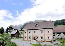 Piendlhof in Göriach | |
 Coat of arms | |
 Göriach Location within Austria | |
| Coordinates: 47°10′29″N 13°45′53″E / 47.17472°N 13.76472°E | |
| Country | Austria |
| State | Salzburg |
| District | Tamsweg |
| Government | |
| • Mayor | Waltraud Grall (ÖVP) |
| Area | |
| • Total | 44.15 km2 (17.05 sq mi) |
| Elevation | 1,180 m (3,870 ft) |
| Population (2018-01-01)[2] | |
| • Total | 337 |
| • Density | 7.6/km2 (20/sq mi) |
| Time zone | UTC+1 (CET) |
| • Summer (DST) | UTC+2 (CEST) |
| Postal code | 5571 |
| Area code | 06483 |
| Vehicle registration | TA |
| Website | www.gemeinde-goeriach.at |
Göriach is a municipality in the district of Tamsweg in the state of Salzburg in Austria.
Geography
Göriach lies about 6 km northwest of Tamsweg and about 80 km southeast of Salzburg. It lies in the Göriach valley on the south side of the Schladminger Tauern.
References
- ↑ "Dauersiedlungsraum der Gemeinden Politischen Bezirke und Bundesländer - Gebietsstand 1.1.2018". Statistics Austria. Retrieved 10 March 2019.
- ↑ "Einwohnerzahl 1.1.2018 nach Gemeinden mit Status, Gebietsstand 1.1.2018". Statistics Austria. Retrieved 9 March 2019.
This article is issued from Wikipedia. The text is licensed under Creative Commons - Attribution - Sharealike. Additional terms may apply for the media files.