Frétigny | |
|---|---|
Part of Saintigny | |
.svg.png.webp) Coat of arms | |
Location of Frétigny | |
 Frétigny 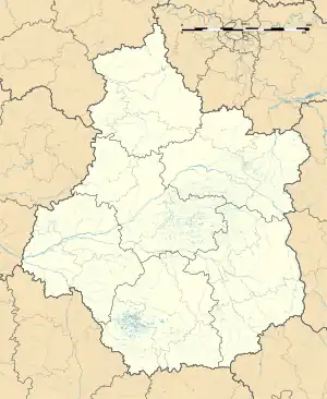 Frétigny | |
| Coordinates: 48°22′24″N 0°58′16″E / 48.3733°N 0.9711°E | |
| Country | France |
| Region | Centre-Val de Loire |
| Department | Eure-et-Loir |
| Arrondissement | Nogent-le-Rotrou |
| Canton | Nogent-le-Rotrou |
| Commune | Saintigny |
| Area 1 | 22.99 km2 (8.88 sq mi) |
| Population (2019)[1] | 508 |
| • Density | 22/km2 (57/sq mi) |
| Time zone | UTC+01:00 (CET) |
| • Summer (DST) | UTC+02:00 (CEST) |
| Postal code | 28480 |
| Elevation | 158–281 m (518–922 ft) (avg. 228 m or 748 ft) |
| 1 French Land Register data, which excludes lakes, ponds, glaciers > 1 km2 (0.386 sq mi or 247 acres) and river estuaries. | |
Frétigny (French pronunciation: [fʁetiɲi]) is a former commune in the Eure-et-Loir department in northern France. On 1 January 2019, it was merged into the new commune Saintigny.[2]
Population
| Year | Pop. | ±% |
|---|---|---|
| 1962 | 486 | — |
| 1968 | 511 | +5.1% |
| 1975 | 465 | −9.0% |
| 1982 | 342 | −26.5% |
| 1990 | 368 | +7.6% |
| 1999 | 429 | +16.6% |
| 2008 | 480 | +11.9% |
See also
References
- ↑ Téléchargement du fichier d'ensemble des populations légales en 2019, INSEE
- ↑ Arrêté préfectoral 19 December 2018 (in French)
Wikimedia Commons has media related to Frétigny.
This article is issued from Wikipedia. The text is licensed under Creative Commons - Attribution - Sharealike. Additional terms may apply for the media files.