| Erer River | |
|---|---|
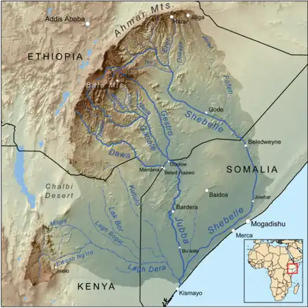 Map of the Jubba/Shebelle drainage basin | |
| Location | |
| Country | Ethiopia |
| Physical characteristics | |
| Source | |
| • location | near |
| • coordinates | 9°19′30″N 42°04′43″E / 9.32500°N 42.07861°E |
| Mouth | |
• location | Shebelle River |
• coordinates | 7°33′43″N 42°01′43″E / 7.56194°N 42.02861°E |
The Erer is a perennial river of eastern Ethiopia.[1] It rises near the city of Harar, and flows in a primarily southern direction to its confluence with the Shabelle at 7°33′43″N 42°01′43″E / 7.56194°N 42.02861°E.
See also
References
- ↑ "Erer River, Ethiopia - Geographical Names, map, geographic coordinates". geographic.org. Retrieved 2022-10-14.
This article is issued from Wikipedia. The text is licensed under Creative Commons - Attribution - Sharealike. Additional terms may apply for the media files.