East Aitape Rural LLG | |
|---|---|
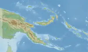 East Aitape Rural LLG Location within Papua New Guinea | |
| Coordinates: 3°08′30″S 142°20′59″E / 3.141705°S 142.349762°E | |
| Country | Papua New Guinea |
| Province | Sandaun Province |
| Time zone | UTC+10 (AEST) |
East Aitape Rural LLG is a local-level government (LLG) of Sandaun Province, Papua New Guinea.[1][2] Arapesh and Schouten languages are spoken in this LLG.
Wards
- 03. Poltulul
- 04. Tales-Iambu
- 05. Tumeleo Island (Tumleo language speakers)
- 06. Ali Island (Kap language speakers)
- 07. Seleo Island (Kap language speakers)
- 08. Poro Settlement
- 09. Lupai
- 10. Wauningi
- 11. Pes
- 12. Prou/Vokau
- 13. Lemieng
- 14. Chinapeli
- 15. Kiriel-Kopom
- 16. Paup
- 17. Yakamul 1 (Kap language speakers)
- 18. Yakamul 2 (Kap language speakers)
- 19. Ulau 1 (Ulau-Suain language speakers)
- 20. Ulau 2 (Ulau-Suain language speakers)
- 21. Suain (Ulau-Suain language speakers)
- 22. Labuain
- 23. Wamsis (Abu’ Arapesh language speakers)[3][4]
- 24. Balup (Abu’ Arapesh language speakers)
- 25. Matapau (Abu’ Arapesh language speakers)
- 80. Aitape Urban
Islands
Islands located within the LLG are:[4]
References
- ↑ "Census Figures by Wards – Momase Region". www.nso.gov.pg. 2011 National Population and Housing Census: Ward Population Profile. Port Moresby: National Statistical Office, Papua New Guinea. 2014. Archived from the original on 2019-05-19. Retrieved 2019-06-04.
- ↑ "Final Figures". www.nso.gov.pg. 2011 National Population and Housing Census: Ward Population Profile. Port Moresby: National Statistical Office, Papua New Guinea. 2014.
- ↑ Eberhard, David M.; Simons, Gary F.; Fennig, Charles D., eds. (2019). "Papua New Guinea languages". Ethnologue: Languages of the World (22nd ed.). Dallas: SIL International.
- 1 2 United Nations in Papua New Guinea (2018). "Papua New Guinea Village Coordinates Lookup". Humanitarian Data Exchange. 1.31.9.
- OCHA FISS (2018). "Papua New Guinea administrative level 0, 1, 2, and 3 population statistics and gazetteer". Humanitarian Data Exchange. 1.31.9.
- United Nations in Papua New Guinea (2018). "Papua New Guinea Village Coordinates Lookup". Humanitarian Data Exchange. 1.31.9.
This article is issued from Wikipedia. The text is licensed under Creative Commons - Attribution - Sharealike. Additional terms may apply for the media files.