Dovadola | |
|---|---|
| Comune di Dovadola | |
 | |
 Coat of arms | |
Location of Dovadola | |
 Dovadola Location of Dovadola in Italy 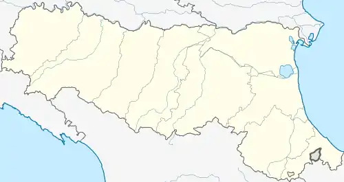 Dovadola Dovadola (Emilia-Romagna) | |
| Coordinates: 44°7′N 11°53′E / 44.117°N 11.883°E | |
| Country | Italy |
| Region | Emilia-Romagna |
| Province | Forlì-Cesena (FC) |
| Government | |
| • Mayor | Francesco Tassinari |
| Area | |
| • Total | 38.97 km2 (15.05 sq mi) |
| Elevation | 143 m (469 ft) |
| Population (31 July 2017)[2] | |
| • Total | 1,595 |
| • Density | 41/km2 (110/sq mi) |
| Demonym | Dovadolesi |
| Time zone | UTC+1 (CET) |
| • Summer (DST) | UTC+2 (CEST) |
| Postal code | 47013 |
| Dialing code | 0543 |
| Patron saint | St. Andrew Apostle |
| Saint day | November 30 |
| Website | Official website |
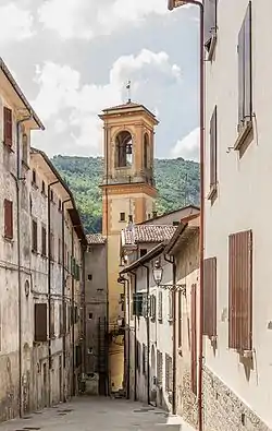
Dovadola (Romagnol: Dvêdla) is a comune (municipality) in the Province of Forlì-Cesena in the Italian region Emilia-Romagna, located about 60 kilometres (37 mi) southeast of Bologna and about 20 kilometres (12 mi) southwest of Forlì, on the road leading to Florence.
Dovadola borders the following municipalities: Castrocaro Terme e Terra del Sole, Modigliana, Predappio, Rocca San Casciano.
References
- ↑ "Superficie di Comuni Province e Regioni italiane al 9 ottobre 2011". Italian National Institute of Statistics. Retrieved 16 March 2019.
- ↑ All demographics and other statistics: Italian statistical institute Istat.
This article is issued from Wikipedia. The text is licensed under Creative Commons - Attribution - Sharealike. Additional terms may apply for the media files.