| Crown Hill Formation | |
|---|---|
| Stratigraphic range: | |
| Type | Formation |
| Unit of | Musgravetown Group[1] |
| Underlies |
|
| Lithology | |
| Primary | Volcanic non-marine |
| Location | |
| Region | Newfoundland |
| Country | Canada |
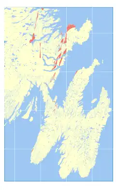 Occurrence in southeast Newfoundland | |
Crown Hill Formation is a late Ediacaran volcanic non-marine sedimentary formation in Newfoundland.[3] It's topped off with a bright red conglomerate, with silt and arkose sands of similar hue too.[4]
It's subdivided into nine facies, including (on Random Island) Brook Point, Duntara Harbour, Red Cliff (with Bluye Point Horizon subfacies') and Broad Head.[2] (on Cape St Mary's) Cross Pt Member, Hurrican Brook Mmbr[5]
References
- ↑ http://geoatlas.gov.nl.ca/Default.htm
- 1 2 Normore, L. S. 2012: GEOLOGY OF THE RANDOM ISLAND MAP AREA (Nts 2C/04), Newfoundland. Current Research (2012) Newfoundland and Labrador Department of Natural Resources Geological Survey Report 12-:121–145.
- ↑ http://gis.gov.nl.ca/minesen/geofiles/display.asp?lit_type_txt=all%20Document%20Types&pageCt=1&lit_type=0&local_file=002C/0058; http://geoatlas.gov.nl.ca/Default.htm
- ↑ Fletcher, T. P. (2006). "Bedrock geology of the Cape St. Mary's Peninsula, southwest Avalon Peninsula, Newfoundland" (PDF): 117.
{{cite journal}}: Cite journal requires|journal=(help) - ↑ (PDF) http://www.nr.gov.nl.ca/nr/mines/geoscience/publications/report06_02.pdf.
{{cite journal}}: Cite journal requires|journal=(help); Missing or empty|title=(help)
This article is issued from Wikipedia. The text is licensed under Creative Commons - Attribution - Sharealike. Additional terms may apply for the media files.