Crowley, Colorado | |
|---|---|
| Town of Crowley[1] | |
 The Crowley County Heritage Center, formerly the Crowley School, is listed in the National Register of Historic Places.[3] | |
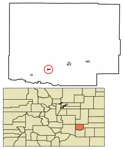 Location of the Town of Crowley in the Crowley County, Colorado. | |
 Crowley Location of the Town of Crowley in the United States. | |
| Coordinates: 38°11′37″N 103°51′35″W / 38.193506°N 103.859744°W[4] | |
| Country | |
| State | |
| County | Crowley County[1] |
| Incorporated | October 10, 1921[5] |
| Government | |
| • Type | Statutory Town[1] |
| Area | |
| • Total | 0.225 sq mi (0.584 km2) |
| • Land | 0.225 sq mi (0.584 km2) |
| • Water | 0.000 sq mi (0.000 km2) |
| Elevation | 4,354 ft (1,327 m) |
| Population | |
| • Total | 166 |
| • Density | 740/sq mi (280/km2) |
| Time zone | UTC−07:00 (MST) |
| • Summer (DST) | UTC−06:00 (MDT) |
| ZIP codes[8] | 81033-81034 |
| Area code | 719 |
| FIPS code | 08-18750 |
| GNIS feature ID | 0195382 |
The Town of Crowley is a Statutory Town in Crowley County, Colorado, United States.[1] The town population was 166 at the 2020 United States Census.[6]
Geography
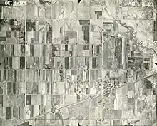
Crowley as photographed by the Soil Conservation Service in 1936.
Crowley is located in southern Crowley County at 38°11′37″N 103°51′28″W / 38.19361°N 103.85778°W (38.193614, -103.857802).[9] Colorado State Highway 96 leads east 6 miles (10 km) to Ordway, the county seat, and west 43 miles (69 km) to Pueblo. Highway 207 leads south 6 miles (10 km) to Manzanola and U.S. Route 50.
At the 2020 United States Census, the town had a total area of 144 acres (0.584 km2), all of it land.[6]
Demographics
| Census | Pop. | Note | %± |
|---|---|---|---|
| 1920 | 224 | — | |
| 1930 | 323 | 44.2% | |
| 1940 | 318 | −1.5% | |
| 1950 | 379 | 19.2% | |
| 1960 | 265 | −30.1% | |
| 1970 | 216 | −18.5% | |
| 1980 | 192 | −11.1% | |
| 1990 | 225 | 17.2% | |
| 2000 | 187 | −16.9% | |
| 2010 | 176 | −5.9% | |
| 2020 | 166 | −5.7% | |
| U.S. Decennial Census | |||
Notable people
Jonathan Almanzar (founder of Chick'nCone)[10]
See also
References
- 1 2 3 4 5 "Active Colorado Municipalities". Colorado Department of Local Affairs. Retrieved October 15, 2021.
- "Crowley County Heritage Center". Archived 2013-09-02 at the Wayback Machine Retrieved 2012-08-27.
- ↑ "Crowley County Heritage Center". Archived 2013-09-02 at the Wayback Machine Retrieved 2012-08-27.
- ↑ "2014 U.S. Gazetteer Files: Places". United States Census Bureau. July 1, 2014. Retrieved January 5, 2015.
- ↑ "Colorado Municipal Incorporations". State of Colorado, Department of Personnel & Administration, Colorado State Archives. December 1, 2004. Retrieved September 2, 2007.
- 1 2 3 4 "Decennial Census P.L. 94-171 Redistricting Data". United States Census Bureau, United States Department of Commerce. August 12, 2021. Retrieved September 4, 2021.
- ↑ "US Board on Geographic Names". United States Geological Survey. October 25, 2007. Retrieved January 31, 2008.
- ↑ "ZIP Code Lookup". United States Postal Service. Archived from the original (JavaScript/HTML) on November 4, 2010. Retrieved September 6, 2007.
- ↑ "US Gazetteer files: 2010, 2000, and 1990". United States Census Bureau. February 12, 2011. Retrieved April 23, 2011.
- ↑ "Founders". Chick'nCone. Retrieved June 3, 2018.
External links
Wikimedia Commons has media related to Crowley, Colorado.
Municipalities and communities of Crowley County, Colorado, United States | ||
|---|---|---|
| Towns |  Map of Colorado highlighting Crowley County | |
This article is issued from Wikipedia. The text is licensed under Creative Commons - Attribution - Sharealike. Additional terms may apply for the media files.