Coquimatlán | |
|---|---|
Municipal seat and city | |
 Coquimatlan | |
 Coat of arms | |
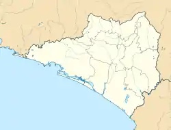 Coquimatlán Location within Colima 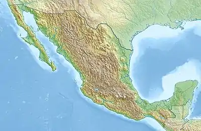 Coquimatlán Location within Mexico | |
| Coordinates: 19°12′13.6″N 103°48′31″W / 19.203778°N 103.80861°W | |
| Country | |
| State | Colima |
| Municipality | Coquimatlán |
| Population (2010) | |
| • Municipality | 19,385 |
| • Seat | 13,358 |
Coquimatlán is a city and seat of the municipality of Coquimatlán, in the Mexican state of Colima. As of 2005, it had a population of 11,374.[1]
Geography
Climate
| Climate data for Coquimatlán | |||||||||||||
|---|---|---|---|---|---|---|---|---|---|---|---|---|---|
| Month | Jan | Feb | Mar | Apr | May | Jun | Jul | Aug | Sep | Oct | Nov | Dec | Year |
| Mean daily maximum °C (°F) | 32.9 (91.2) |
33.3 (91.9) |
34 (93) |
35 (95) |
35.6 (96.1) |
34.9 (94.8) |
34.3 (93.7) |
34.0 (93.2) |
33.2 (91.8) |
34.0 (93.2) |
34.1 (93.4) |
33.0 (91.4) |
34.0 (93.2) |
| Mean daily minimum °C (°F) | 15.8 (60.4) |
15.4 (59.7) |
15.4 (59.7) |
16.2 (61.2) |
18.4 (65.1) |
21.3 (70.3) |
21.4 (70.5) |
21.2 (70.2) |
21.2 (70.2) |
20.6 (69.1) |
18.6 (65.5) |
16.8 (62.2) |
18.5 (65.3) |
| Average precipitation mm (inches) | 28 (1.1) |
7.6 (0.3) |
5.1 (0.2) |
2.5 (0.1) |
10 (0.4) |
110 (4.4) |
180 (7.1) |
190 (7.4) |
180 (7.1) |
91 (3.6) |
18 (0.7) |
13 (0.5) |
840 (32.9) |
| Source: Weatherbase [2] | |||||||||||||
References
- ↑ Instituto Nacional de Estadística y Geografía. Principales resultados por localidad 2005 (ITER). Retrieved on November 9, 2008
- ↑ "Weatherbase: Historical Weather for Coquimatlán, Colima". Weatherbase. 2011. Retrieved on November 24, 2011.
Colima (capital) | ||
| Municipalities (municipal seats) |  | |
This article is issued from Wikipedia. The text is licensed under Creative Commons - Attribution - Sharealike. Additional terms may apply for the media files.