Condé-sur-Huisne | |
|---|---|
Part of Sablons-sur-Huisne | |
Location of Condé-sur-Huisne | |
 Condé-sur-Huisne 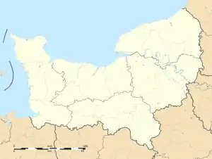 Condé-sur-Huisne | |
| Coordinates: 48°22′53″N 0°51′04″E / 48.3814°N 0.8511°E | |
| Country | France |
| Region | Normandy |
| Department | Orne |
| Arrondissement | Mortagne-au-Perche |
| Canton | Bretoncelles |
| Commune | Sablons-sur-Huisne |
| Area 1 | 17.51 km2 (6.76 sq mi) |
| Population (2019)[1] | 1,282 |
| • Density | 73/km2 (190/sq mi) |
| Time zone | UTC+01:00 (CET) |
| • Summer (DST) | UTC+02:00 (CEST) |
| Postal code | 61110 |
| Elevation | 107–220 m (351–722 ft) |
| 1 French Land Register data, which excludes lakes, ponds, glaciers > 1 km2 (0.386 sq mi or 247 acres) and river estuaries. | |
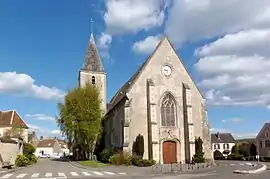
France Normandie Conde sur Huisne Eglise
Condé-sur-Huisne (French pronunciation: [kɔ̃de syʁ ɥin] ⓘ, literally Condé on Huisne) is a former commune in the Orne department in north-western France. On 1 January 2016, it was merged into the new commune of Sablons-sur-Huisne.[2]
Description
Condé-sur-Huisne lies between the towns of Condeau to its east and Verrières to its west and Saint-Germain-des-Grois to its north and Nogent-le-Rotrou to its south.
Condé-sur-Huisne has a large, high feudal mound where a square keep castle was built but destroyed in 1428 by the English during the Hundred Years' War. Only a half-buried, lower chapel dedicated to Saint John the Baptist (12th century) remains.[3]
See also
References
- ↑ Téléchargement du fichier d'ensemble des populations légales en 2019, INSEE
- ↑ Arrêté préfectoral 25 September 2015 (in French)
- ↑ "Circuit touristique des Vallées & moulins". Nogent-le-Rotrou Tourism: 5. Archived from the original on August 30, 2016. Retrieved December 5, 2018.
{{cite journal}}: Cite journal requires|journal=(help)
Wikimedia Commons has media related to Condé-sur-Huisne.
This article is issued from Wikipedia. The text is licensed under Creative Commons - Attribution - Sharealike. Additional terms may apply for the media files.