Combourtillé
| |
|---|---|
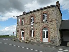 Town hall | |
Location of Combourtillé | |
 Combourtillé  Combourtillé | |
| Coordinates: 48°16′22″N 1°14′39″W / 48.2728°N 1.2442°W | |
| Country | France |
| Region | Brittany |
| Department | Ille-et-Vilaine |
| Arrondissement | Fougères-Vitré |
| Canton | Fougères-1 |
| Intercommunality | Fougères Agglomération |
| Government | |
| • Mayor (2020–2026) | Roland Bouvet[1] |
| Area 1 | 9.25 km2 (3.57 sq mi) |
| Population | 613 |
| • Density | 66/km2 (170/sq mi) |
| Time zone | UTC+01:00 (CET) |
| • Summer (DST) | UTC+02:00 (CEST) |
| INSEE/Postal code | 35086 /35210 |
| Elevation | 72–130 m (236–427 ft) |
| 1 French Land Register data, which excludes lakes, ponds, glaciers > 1 km2 (0.386 sq mi or 247 acres) and river estuaries. | |
Combourtillé (French pronunciation: [kɔ̃buʁtije]; Gallo: Conbórtilhaè, Breton: Komorzhel) is a commune in the Ille-et-Vilaine department of Brittany in north-western France.
Population
Inhabitants of Combourtillé are called Combourtilléens in French.
| Year | Pop. | ±% |
|---|---|---|
| 1962 | 407 | — |
| 1968 | 416 | +2.2% |
| 1975 | 370 | −11.1% |
| 1982 | 340 | −8.1% |
| 1990 | 363 | +6.8% |
| 1999 | 401 | +10.5% |
| 2008 | 562 | +40.1% |
See also
References
- ↑ "Répertoire national des élus: les maires". data.gouv.fr, Plateforme ouverte des données publiques françaises (in French). 2 December 2020.
- ↑ "Populations légales 2021". The National Institute of Statistics and Economic Studies. 28 December 2023.
External links
Wikimedia Commons has media related to Combourtillé.
- Mayors of Ille-et-Vilaine Association Archived 14 January 2012 at the Wayback Machine (in French)
This article is issued from Wikipedia. The text is licensed under Creative Commons - Attribution - Sharealike. Additional terms may apply for the media files.