Coka
草卡镇 | |
|---|---|
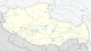 Coka Location within Tibet Autonomous Region | |
| Coordinates: 30°54′11″N 94°40′16″E / 30.90306°N 94.67111°E | |
| Country | China |
| Region | Tibet Autonomous Region |
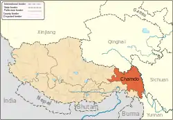
| Prefecture | Chamdo |
| County | Banbar |
| Area | |
| • Total | 451 km2 (174 sq mi) |
| Elevation | 3,734 m (12,251 ft) |
| 4000 | |
| Time zone | UTC+8 (China Standard) |
Coka (Chinese: 草卡; pinyin: Cǎokǎ; Standard Tibetan: མཚོ་ཁ།) is a town in Banbar County, Chamdo Prefecture, in the east of the Tibet Autonomous Region, China. It lies just 5 km (3.1 mi) to the southwest of Banbar, and is serviced by Tibet Regional Highway 303 (S303).[1] The administrative division covers an area of 451 km2 (174 sq mi), and as of 2004 had a population of 4,000.[2]
Administrative divisions
The township contains the following village-level divisions:[2]
- Dongtuo Community (东托社区)
- Geji Village (格吉村)
- Wangka Village (旺卡村)
- Suocun Village (索村)
- Laiyi Village (来义村)
- Latuo Village (拉托村)
- Cangba Village (藏巴村)
- Zhuogui Village (卓归村)
- Changsha Village (昌沙村)
- Maijia Village (麦加村)
- Dagen Village (达根村)
- Lagong Village (拉贡村)
- Danda Village (丹达村)
- Sudong Village (苏东村)
References
- ↑ Maps (Map). Google Maps.
- 1 2 "Coka Town". CF Guide. Retrieved 28 May 2012.
This article is issued from Wikipedia. The text is licensed under Creative Commons - Attribution - Sharealike. Additional terms may apply for the media files.