Clonmel, Kansas | |
|---|---|
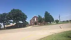 St. John the Evangelist Church (2018) | |
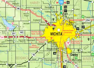 KDOT map of Sedgwick County (legend) | |
 Clonmel  Clonmel | |
| Coordinates: 37°33′46″N 97°33′14″W / 37.56278°N 97.55389°W[1] | |
| Country | United States |
| State | Kansas |
| County | Sedgwick |
| Township | Illinois |
| Elevation | 1,371 ft (418 m) |
| Time zone | UTC-6 (CST) |
| • Summer (DST) | UTC-5 (CDT) |
| ZIP code | 67149 |
| Area code | 620 |
| FIPS code | 20-14375 [1] |
| GNIS ID | 484677 [1] |
Clonmel is an unincorporated community in Illinois Township, Sedgwick County, Kansas, United States.[1] It is located at Highway K42 and W 71st St S.
History
Clonmel was a station on the Kansas City, Mexico and Orient Railway.[2]
A post office was opened in Clonmel in 1905, and remained in operation until it was discontinued in 1938.[3] It was named after Clonmel in Ireland.[4]
Education
The community is served by Clearwater USD 264 public school district.
References
- 1 2 3 4 5 "Clonmel, Kansas", Geographic Names Information System, United States Geological Survey, United States Department of the Interior
- ↑ Blackmar, Frank Wilson (1912). Kansas: A Cyclopedia of State History, Embracing Events, Institutions, Industries, Counties, Cities, Towns, Prominent Persons, Etc. Standard Publishing Company. p. 370. ISBN 9780722249055.
- ↑ "Kansas Post Offices, 1828-1961". Kansas Historical Society. Archived from the original on October 9, 2013. Retrieved June 23, 2014.
- ↑ Stewart, George R. (1970). American place-names; a concise and selective dictionary for the continental United States of America. New York: Oxford University Press.
Further reading
External links
Municipalities and communities of Sedgwick County, Kansas, United States | ||
|---|---|---|
| Cities | 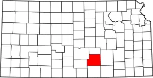 Map of Kansas highlighting Sedgwick County | |
| Unincorporated communities | ||
| Townships | ||
| Footnotes | †This community is designated a Census-Designated Place (CDP) by the United States Census Bureau. ‡This community also has portions in an adjacent county or counties. | |
This article is issued from Wikipedia. The text is licensed under Creative Commons - Attribution - Sharealike. Additional terms may apply for the media files.