Churcampa | |
|---|---|
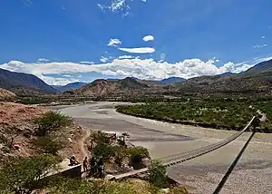 Footbridge across Mantaro River in Chaypara, La Merced District | |
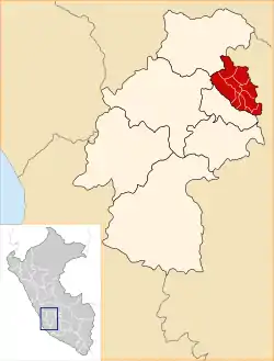 Location of Churcampa in the Huancavelica Region | |
| Country | Peru |
| Region | Huancavelica |
| Capital | Churcampa |
| Government | |
| • Mayor | Robert Juan Rojas Meza (2007) |
| Area | |
| • Total | 1,232.45 km2 (475.85 sq mi) |
| Population | |
| • Total | 42,755 |
| • Density | 35/km2 (90/sq mi) |
| UBIGEO | 0905 |
The Churcampa Province is a province located in the Huancavelica Region of Peru. It is one of the seven that make up that region. The capital of the province is Churcampa.
Boundaries
- North: Tayacaja Province
- East: Ayacucho Region
- South: Acobamba Province
- West: Huancavelica Province
Geography
Some of the highest mountains of the province are listed below:[1]
- Allquchayuq
- Artisa
- Chawpi Urqu
- Hamp'atuyuq
- Hamp'atuyuq (Pachamarca)
- Hatun Pampa
- Ichhu Pata
- Ichhu Ukhu
- Luychu Q'asa
- Llaqta Urqu
- Mamacha Urqu
- Muruqucha
- Muyu Urqu
- Ñawpa Llaqta Urqu
- Puka Pampa
- Qiwllaqucha
- Q'illu Urqu
- Q'iru Q'asa
- Saywa
- Suyu Qaqa
- Wisk'achayuq
- Yana P'unqu
- Yana Urqu (Chinchihuasi-Cosme)
- Yana Urqu (Coris-Locroja)
- Yana Willka
- Yuraq Yuraq
Political division
The province is divided into eleven districts, which are:
- Anco (La Esmeralda)
- Chinchihuasi (Chinchihuasi)
- Churcampa (Churcampa)
- El Carmen (Paucarbambilla)
- La Merced (La Merced)
- Lacroja (Locroja)
- Pachamarca (Pachamarca)
- Paucarbamba (Paucarbamba)
- San Miguel de Mayocc (Mayocc)
- San Pedro de Coris (San Pedro de Coris)
- Cosme (Santa Clara de Cosme)
Ethnic groups
The people in the province are mainly Indigenous citizens of Quechua descent. Quechua is the language which the majority of the population (79.11%) learnt to speak in childhood, 20.46% of the residents started speaking using the Spanish language (2007 Peru Census).[2]
References
- ↑ escale.minedu.gob.pe/ UGEL map Churcampa Province (Huancavelica Region)
- ↑ inei.gob.pe Archived January 27, 2013, at the Wayback Machine INEI, Peru, Censos Nacionales 2007
| |
|---|---|
12°43′22″S 74°25′16″W / 12.722847°S 74.421214°W
This article is issued from Wikipedia. The text is licensed under Creative Commons - Attribution - Sharealike. Additional terms may apply for the media files.