Chupampa | |
|---|---|
| Country | |
| Province | Herrera |
| District | Santa María |
| Area | |
| • Land | 22.7 km2 (8.8 sq mi) |
| Population (2010)[1] | |
| • Total | 1,231 |
| • Density | 54.3/km2 (141/sq mi) |
| Population density calculated based on land area. | |
| Time zone | UTC−5 (EST) |
Chupampa is a corregimiento in Santa María District, Herrera Province, Panama with a population of 1,231 as of 2010.[1] Its population as of 1990 was 2,448; its population as of 2000 was 1,237.[1]
References
- 1 2 3 4 "Cuadro 11 (Superficie, población y densidad de población en la República...)" Archived 2016-03-04 at the Wayback Machine Table 11 (Area, population, and population density in the Republic...) (.xls). In "Resultados Finales Básicos" [Basic Final Results] (in Spanish). National Institute of Statistics and Census of Panama. Archived from the original on July 10, 2015. Retrieved May 26, 2015.
Capital: Chitré | ||
| Chitré District | 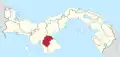 | |
| Las Minas District | ||
| Los Pozos District | ||
| Ocú District | ||
| Parita District | ||
| Pesé District | ||
| Santa María | ||
8°05′00″N 80°47′00″W / 8.0833°N 80.7833°W
This article is issued from Wikipedia. The text is licensed under Creative Commons - Attribution - Sharealike. Additional terms may apply for the media files.