Chula, Georgia | |
|---|---|
 Post office | |
 Chula, Georgia | |
| Coordinates: 31°32′59″N 83°32′51″W / 31.54972°N 83.54750°W | |
| Country | United States |
| State | Georgia |
| County | Tift |
| Elevation | 384 ft (117 m) |
| Time zone | UTC-5 (Eastern (EST)) |
| • Summer (DST) | UTC-4 (EDT) |
| ZIP code | 31733 |
| Area code | 229 |
| GNIS feature ID | 355165[1] |
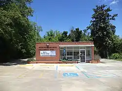
Chula is an unincorporated community in Tift County, Georgia, United States. The community is located along U.S. Route 41 near Interstate 75, 7.2 miles (11.6 km) north-northwest of Tifton. Chula has a post office with ZIP code 31733.[2][3]
History
An early variant name was "Ruby".[4] The Georgia General Assembly incorporated the place in 1904 as the "Town of Chula".[5] The town's municipal charter was repealed in 1906.[4]
References
- ↑ "Chula". Geographic Names Information System. United States Geological Survey, United States Department of the Interior.
- ↑ United States Postal Service. "USPS - Look Up a ZIP Code". Retrieved November 21, 2015.
- ↑ "Postmaster Finder - Post Offices by ZIP Code". United States Postal Service. Archived from the original on October 17, 2020. Retrieved November 21, 2015.
- 1 2 Krakow, Kenneth K. (1975). Georgia Place-Names: Their History and Origins (PDF). Macon, GA: Winship Press. p. 44. ISBN 0-915430-00-2.
- ↑ Georgia (1904). Acts and Resolutions of the General Assembly of the State of Georgia. Clark & Hines, State Printers. p. 404.
Municipalities and communities of Tift County, Georgia, United States | ||
|---|---|---|
| Cities | 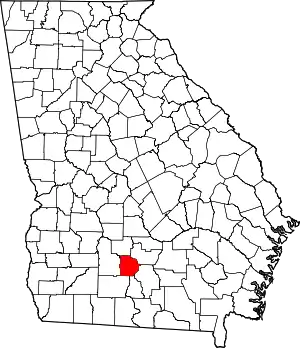 Map of Georgia highlighting Tift County | |
| CDPs | ||
| Unincorporated communities | ||
| Footnotes | ‡This populated place also has portions in an adjacent county or counties | |
This article is issued from Wikipedia. The text is licensed under Creative Commons - Attribution - Sharealike. Additional terms may apply for the media files.