Chastel-sur-Murat | |
|---|---|
Part of Murat | |
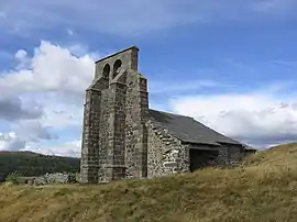 The Chapel of Saint-Antoine, in Chastel-sur-Murat | |
Location of Chastel-sur-Murat | |
 Chastel-sur-Murat  Chastel-sur-Murat | |
| Coordinates: 45°07′30″N 2°51′29″E / 45.125°N 2.8581°E | |
| Country | France |
| Region | Auvergne-Rhône-Alpes |
| Department | Cantal |
| Arrondissement | Saint-Flour |
| Canton | Murat |
| Commune | Murat |
| Area 1 | 13.79 km2 (5.32 sq mi) |
| Population (2019)[1] | 108 |
| • Density | 7.8/km2 (20/sq mi) |
| Time zone | UTC+01:00 (CET) |
| • Summer (DST) | UTC+02:00 (CEST) |
| Postal code | 15300 |
| Elevation | 1,000–1,360 m (3,280–4,460 ft) (avg. 1,100 m or 3,600 ft) |
| 1 French Land Register data, which excludes lakes, ponds, glaciers > 1 km2 (0.386 sq mi or 247 acres) and river estuaries. | |
Chastel-sur-Murat (French pronunciation: [ʃastɛl syʁ myʁa], literally Chastel on Murat; Auvergnat: Chastèl sobre Murat) is a former commune in the Cantal department in south-central France. On 1 January 2017, it was merged into the commune Murat.[2]
Population
| Year | Pop. | ±% |
|---|---|---|
| 1962 | 132 | — |
| 1968 | 154 | +16.7% |
| 1975 | 126 | −18.2% |
| 1982 | 106 | −15.9% |
| 1990 | 100 | −5.7% |
| 1999 | 96 | −4.0% |
| 2008 | 133 | +38.5% |
See also
References
- ↑ Téléchargement du fichier d'ensemble des populations légales en 2019, INSEE
- ↑ Arrêté préfectoral 16 December 2016 (in French)
Wikimedia Commons has media related to Chastel-sur-Murat.
This article is issued from Wikipedia. The text is licensed under Creative Commons - Attribution - Sharealike. Additional terms may apply for the media files.