Calendasco | |
|---|---|
| Comune di Calendasco | |
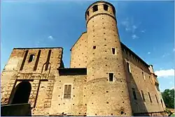 The 12th-century castle of Calendasco. | |
 Coat of arms | |
Location of Calendasco | |
 Calendasco Location of Calendasco in Italy 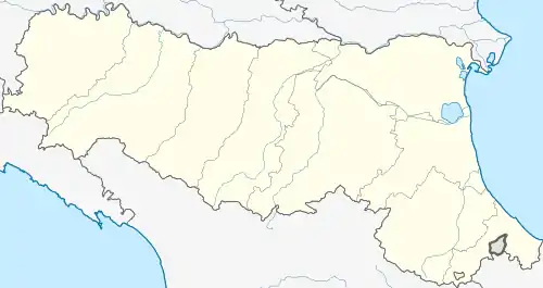 Calendasco Calendasco (Emilia-Romagna) | |
| Coordinates: 45°5′N 9°36′E / 45.083°N 9.600°E | |
| Country | Italy |
| Region | Emilia-Romagna |
| Province | Piacenza (PC) |
| Frazioni | Boscone Cusani, Cotrebbia Nuova |
| Government | |
| • Mayor | Francesco Zangrandi |
| Area | |
| • Total | 37.3 km2 (14.4 sq mi) |
| Elevation | 55 m (180 ft) |
| Population (31 August 2007)[2] | |
| • Total | 2,412 |
| • Density | 65/km2 (170/sq mi) |
| Demonym | Calendaschesi |
| Time zone | UTC+1 (CET) |
| • Summer (DST) | UTC+2 (CEST) |
| Postal code | 29010 |
| Dialing code | 0523 |
| Website | Official website |
Calendasco (Piacentino: Calindasch) is a comune (municipality) in the Province of Piacenza in the Italian region Emilia-Romagna, located about 150 kilometres (93 mi) northwest of Bologna and about 9 kilometres (6 mi) northwest of Piacenza.
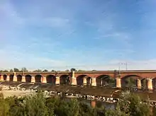
Bridge on the Trebia
Calendasco was founded along the Via Emilia; entering the town over the bridge over the Trebbia River is a plaque commemorating the Battle of Trebbia (213 BC) where the army of Hannibal defeated the Romans.
References
- ↑ "Superficie di Comuni Province e Regioni italiane al 9 ottobre 2011". Italian National Institute of Statistics. Retrieved 16 March 2019.
- ↑ All demographics and other statistics: Italian statistical institute Istat.

This article is issued from Wikipedia. The text is licensed under Creative Commons - Attribution - Sharealike. Additional terms may apply for the media files.