Cactus Forest, Arizona | |
|---|---|
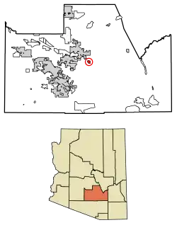 Location of Cactus Forest in Pinal County, Arizona. | |
 Cactus Forest, Arizona Location in the United States | |
| Coordinates: 32°57′28″N 111°19′1″W / 32.95778°N 111.31694°W | |
| Country | United States |
| State | Arizona |
| County | Pinal |
| Area | |
| • Total | 2.73 sq mi (7.08 km2) |
| • Land | 2.73 sq mi (7.08 km2) |
| • Water | 0.00 sq mi (0.00 km2) |
| Population (2020) | |
| • Total | 606 |
| • Density | 221.82/sq mi (85.64/km2) |
| Time zone | UTC-7 (MST (no DST)) |
| ZIP code | 85132[2] |
| Area code | 520 |
| FIPS code | 04-08990 |
Cactus Forest is a census-designated place (CDP) in Pinal County, Arizona, United States. The population was 594 at the 2010 census.
Demographics
| Census | Pop. | Note | %± |
|---|---|---|---|
| 2010 | 594 | — | |
| 2020 | 606 | 2.0% | |
| U.S. Decennial Census[3] | |||
Cactus Forest first appeared on the 2010 U.S. Census as a census-designated place (CDP).[4]
As of the census[5] of 2010, there were 594 people living in the CDP. The population density was 217.4 people per square mile. The racial makeup of the CDP was 87% White, 2% Black or African American, 4% Native American, <1% Asian, 5% from other races, and 3% from two or more races. 21% of the population were Hispanic or Latino of any race.
Notes
- ↑ "2020 U.S. Gazetteer Files". United States Census Bureau. Retrieved October 29, 2021.
- ↑ "Cactus Forest AZ ZIP Code". zipdatamaps.com. 2023. Retrieved May 3, 2023.
- ↑ "Census of Population and Housing". Census.gov. Retrieved June 4, 2016.
- ↑ U.S. Census Bureau (October 2012). "Arizona: 2010 - Summary Population and Housing Characteristics" (PDF). U.S. Government Printing Office.
- ↑ "American FactFinder". Archived from the original on July 21, 2011. Retrieved April 27, 2011.
Municipalities and communities of Pinal County, Arizona, United States | ||
|---|---|---|
| Cities | 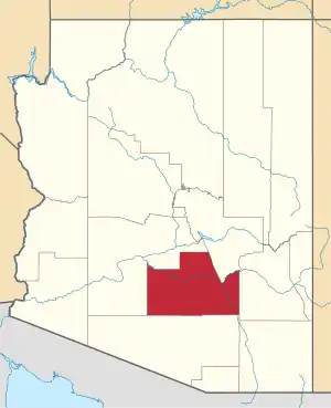 | |
| Towns | ||
| CDPs |
| |
| Populated places | ||
| Indian reservations | ||
| Ghost towns | ||
| Footnotes | ‡This populated place also has portions in an adjacent county or counties | |
This article is issued from Wikipedia. The text is licensed under Creative Commons - Attribution - Sharealike. Additional terms may apply for the media files.