Bridoré | |
|---|---|
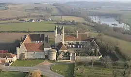 Chateau | |
Location of Bridoré | |
 Bridoré 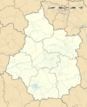 Bridoré | |
| Coordinates: 47°01′40″N 1°05′00″E / 47.0278°N 1.0833°E | |
| Country | France |
| Region | Centre-Val de Loire |
| Department | Indre-et-Loire |
| Arrondissement | Loches |
| Canton | Loches |
| Intercommunality | CC Loches Sud Touraine |
| Government | |
| • Mayor (2020–2026) | Pascale Morel[1] |
| Area 1 | 14.54 km2 (5.61 sq mi) |
| Population | 483 |
| • Density | 33/km2 (86/sq mi) |
| Time zone | UTC+01:00 (CET) |
| • Summer (DST) | UTC+02:00 (CEST) |
| INSEE/Postal code | 37039 /37600 |
| Elevation | 76–144 m (249–472 ft) |
| 1 French Land Register data, which excludes lakes, ponds, glaciers > 1 km2 (0.386 sq mi or 247 acres) and river estuaries. | |
Bridoré (French pronunciation: [bʁidɔʁe] ⓘ) is a commune in the Indre-et-Loire department in central France.
Population
| Year | Pop. | ±% p.a. |
|---|---|---|
| 1968 | 373 | — |
| 1975 | 363 | −0.39% |
| 1982 | 426 | +2.31% |
| 1990 | 461 | +0.99% |
| 1999 | 476 | +0.36% |
| 2007 | 500 | +0.62% |
| 2012 | 538 | +1.48% |
| 2017 | 524 | −0.53% |
| Source: INSEE[3] | ||
See also
References
- ↑ "Répertoire national des élus: les maires". data.gouv.fr, Plateforme ouverte des données publiques françaises (in French). 9 August 2021.
- ↑ "Populations légales 2021". The National Institute of Statistics and Economic Studies. 28 December 2023.
- ↑ Population en historique depuis 1968, INSEE
Wikimedia Commons has media related to Bridoré.
This article is issued from Wikipedia. The text is licensed under Creative Commons - Attribution - Sharealike. Additional terms may apply for the media files.