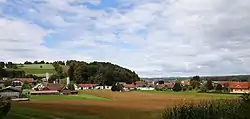
Breitenfeld an der Rittschein | |
|---|---|
 Breitenfeld ad Rittschein | |
 Coat of arms | |
 Breitenfeld an der Rittschein Location within Austria | |
| Coordinates: 47°01′00″N 15°57′00″E / 47.01667°N 15.95000°E | |
| Country | Austria |
| State | Styria |
| District | Südoststeiermark |
| Government | |
| • Mayor | Johann Pußwald (SPÖ) |
| Area | |
| • Total | 13.22 km2 (5.10 sq mi) |
| Elevation | 281 m (922 ft) |
| Population (1 January 2016)[1] | |
| • Total | 786 |
| • Density | 59/km2 (150/sq mi) |
| Time zone | UTC+1 (CET) |
| • Summer (DST) | UTC+2 (CEST) |
| Postal code | 8313, 8333 |
| Area code | +43 3387 |
| Vehicle registration | FB |
| Website | www.breitenfeld.st |
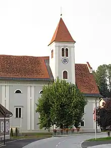
Breitenfeld parish church
Breitenfeld an der Rittschein is a former municipality in the district of Südoststeiermark in the Austrian state of Styria. Since the 2015 Styria municipal structural reform, it is part of the municipality Riegersburg.[2]
Population
| Year | Pop. | ±% |
|---|---|---|
| 1869 | 899 | — |
| 1880 | 882 | −1.9% |
| 1890 | 884 | +0.2% |
| 1900 | 897 | +1.5% |
| 1910 | 886 | −1.2% |
| 1923 | 857 | −3.3% |
| 1934 | 860 | +0.4% |
| 1939 | 819 | −4.8% |
| 1951 | 791 | −3.4% |
| 1961 | 817 | +3.3% |
| 1971 | 873 | +6.9% |
| 1981 | 856 | −1.9% |
| 1991 | 853 | −0.4% |
| 2001 | 815 | −4.5% |
| 2013 | 793 | −2.7% |
References
- ↑ Statistik Austria - Bevölkerung zu Jahresbeginn 2002-2016 nach Gemeinden (Gebietsstand 1.1.2016) for Breitenfeld an der Rittschein.
- ↑ Die neue Gemeindestruktur der Steiermark
This article is issued from Wikipedia. The text is licensed under Creative Commons - Attribution - Sharealike. Additional terms may apply for the media files.