Bosnormand | |
|---|---|
Part of Bosroumois | |
Location of Bosnormand | |
 Bosnormand 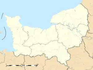 Bosnormand | |
| Coordinates: 49°16′49″N 0°54′33″E / 49.2803°N 0.9092°E | |
| Country | France |
| Region | Normandy |
| Department | Eure |
| Arrondissement | Bernay |
| Canton | Bourgtheroulde-Infreville |
| Commune | Bosroumois |
| Area 1 | 3.34 km2 (1.29 sq mi) |
| Population (2019)[1] | 326 |
| • Density | 98/km2 (250/sq mi) |
| Time zone | UTC+01:00 (CET) |
| • Summer (DST) | UTC+02:00 (CEST) |
| Postal code | 27670 |
| Elevation | 124–161 m (407–528 ft) (avg. 150 m or 490 ft) |
| 1 French Land Register data, which excludes lakes, ponds, glaciers > 1 km2 (0.386 sq mi or 247 acres) and river estuaries. | |
Bosnormand (French pronunciation: [bonɔʁmɑ̃]) is a former commune in the Eure department in Normandy in northern France. On 1 January 2017, it was merged into the new commune Bosroumois.[2]
Population
| Year | Pop. | ±% |
|---|---|---|
| 1962 | 190 | — |
| 1968 | 186 | −2.1% |
| 1975 | 206 | +10.8% |
| 1982 | 233 | +13.1% |
| 1990 | 283 | +21.5% |
| 1999 | 276 | −2.5% |
| 2008 | 326 | +18.1% |
See also
References
- ↑ Téléchargement du fichier d'ensemble des populations légales en 2019, INSEE
- ↑ Arrêté préfectoral 3 August 2016 (in French)
Wikimedia Commons has media related to Bosnormand.
This article is issued from Wikipedia. The text is licensed under Creative Commons - Attribution - Sharealike. Additional terms may apply for the media files.