Boikin/Dagua Rural LLG | |
|---|---|
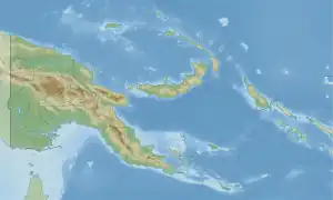 Boikin/Dagua Rural LLG Location within Papua New Guinea | |
| Coordinates: 3°25′40″S 143°26′52″E / 3.427696°S 143.447737°E | |
| Country | Papua New Guinea |
| Province | East Sepik Province |
| Time zone | UTC+10 (AEST) |
Boikin/Dagua Rural LLG is a local-level government (LLG) of East Sepik Province, Papua New Guinea.[1][2]
Wards
- 01. Hawain
- 02. Niumegin
- 03. Aring/Surumba
- 04. Penjen/Peringa
- 05. Siro/Wanjo
- 06. Boikin/Dagua
- 07. Karawap
- 08. You island
- 09. Karasau (Est)
- 10. Banak/Hogi
- 11. Bogumatai/Wautogik
- 12. Dogur
- 13. Woginara (1)
- 14. Woginara (2)
- 15. Sapuain
- 16. Urip
- 17. Mogopin
- 18. Maguer
- 19. Smain/But
- 20. Lowan
- 21. Kauk/Balam
- 22. Sowom
- 23. Kotai
- 24. Kubren
References
- ↑ "Census Figures by Wards - Momase Region". www.nso.gov.pg. 2011 National Population and Housing Census: Ward Population Profile. Port Moresby: National Statistical Office, Papua New Guinea. 2014. Archived from the original on 2019-05-19. Retrieved 2019-06-04.
- ↑ "Final Figures". www.nso.gov.pg. 2011 National Population and Housing Census: Ward Population Profile. Port Moresby: National Statistical Office, Papua New Guinea. 2014. Archived from the original on 2015-09-06. Retrieved 2019-06-04.
- OCHA FISS (2018). "Papua New Guinea administrative level 0, 1, 2, and 3 population statistics and gazetteer". Humanitarian Data Exchange. 1.31.9.
- United Nations in Papua New Guinea (2018). "Papua New Guinea Village Coordinates Lookup". Humanitarian Data Exchange. 1.31.9.
This article is issued from Wikipedia. The text is licensed under Creative Commons - Attribution - Sharealike. Additional terms may apply for the media files.