Blue Pond | |
|---|---|
 Blue Pond Location in Alabama. | |
| Coordinates: 34°14′13″N 85°43′13″W / 34.23694°N 85.72028°W | |
| Country | United States |
| State | Alabama |
| County | Cherokee |
| Elevation | 656 ft (200 m) |
| Time zone | UTC-6 (Central (CST)) |
| • Summer (DST) | UTC-5 (CDT) |
| Area codes | 256 & 938 |
| GNIS feature ID | 156082[1] |
Blue Pond, also spelled Bluepond, is an unincorporated community in Cherokee County, Alabama, United States.
History
A post office called Blue Pond was established in 1850, and remained in operation until it was discontinued in 1907.[2] The community took the name of a neighboring pond.[3]
References
- ↑ "Blue Pond". Geographic Names Information System. United States Geological Survey, United States Department of the Interior.
- ↑ "Cherokee County". Jim Forte Postal History. Retrieved April 25, 2015.
- ↑ "Cherokee County, Ala". Calhoun Times. September 1, 2004. p. 42. Retrieved April 24, 2015.
Municipalities and communities of Cherokee County, Alabama, United States | ||
|---|---|---|
| City | 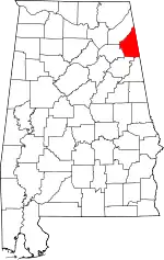 Map of Alabama highlighting Cherokee County | |
| Towns | ||
| CDPs | ||
| Unincorporated communities | ||
| Ghost town | ||
| Footnotes | ‡This populated place also has portions in an adjacent county or counties | |
This article is issued from Wikipedia. The text is licensed under Creative Commons - Attribution - Sharealike. Additional terms may apply for the media files.