Biras | |
|---|---|
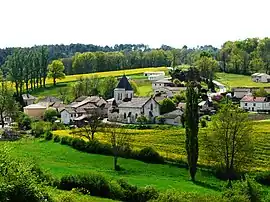 A general view of Biras | |
Location of Biras | |
 Biras 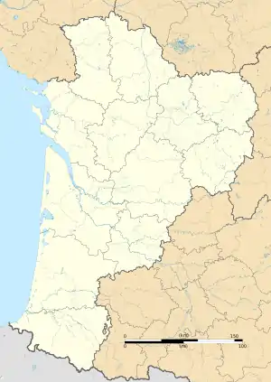 Biras | |
| Coordinates: 45°17′19″N 0°38′22″E / 45.2886°N 0.6394°E | |
| Country | France |
| Region | Nouvelle-Aquitaine |
| Department | Dordogne |
| Arrondissement | Nontron |
| Canton | Brantôme en Périgord |
| Intercommunality | Dronne et Belle |
| Government | |
| • Mayor (2020–2026) | Jean-Michel Nadal[1] |
| Area 1 | 19.43 km2 (7.50 sq mi) |
| Population | 700 |
| • Density | 36/km2 (93/sq mi) |
| Time zone | UTC+01:00 (CET) |
| • Summer (DST) | UTC+02:00 (CEST) |
| INSEE/Postal code | 24042 /24310 |
| Elevation | 119–237 m (390–778 ft) |
| 1 French Land Register data, which excludes lakes, ponds, glaciers > 1 km2 (0.386 sq mi or 247 acres) and river estuaries. | |
Biras (French pronunciation: [biʁa]; Occitan: Biràs) is a commune in the Dordogne department in southwestern France.
Population
| Year | Pop. | ±% |
|---|---|---|
| 1962 | 318 | — |
| 1968 | 344 | +8.2% |
| 1975 | 343 | −0.3% |
| 1982 | 354 | +3.2% |
| 1990 | 372 | +5.1% |
| 1999 | 362 | −2.7% |
| 2008 | 531 | +46.7% |
See also
References
- ↑ "Répertoire national des élus: les maires". data.gouv.fr, Plateforme ouverte des données publiques françaises (in French). 9 August 2021.
- ↑ "Populations légales 2021". The National Institute of Statistics and Economic Studies. 28 December 2023.
External links
Wikimedia Commons has media related to Biras.
- Biras on the map of France
- https://web.archive.org/web/20070513014059/http://www.cc-brantomois.fr/biras.html
This article is issued from Wikipedia. The text is licensed under Creative Commons - Attribution - Sharealike. Additional terms may apply for the media files.