| Besiberri Sud | |
|---|---|
_Mass%C3%ADs_de_Besiberri_-_Besiberri_Sud.JPG.webp) Besiberri Sud; eastern face | |
| Highest point | |
| Elevation | 3,023 m (9,918 ft) |
| Prominence | 36 m (118 ft) |
| Isolation | 315 m (1,033 ft) |
| Listing | Mountains in Catalonia |
| Coordinates | 42°35′37.62″N 00°49′33.63″E / 42.5937833°N 0.8260083°E |
| Geography | |
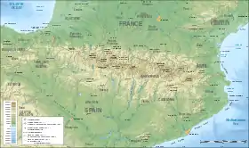 Besiberri Sud Location in the Pyrenees | |
| Location | Vilaller & Vall de Boí (Alta Ribagorça), Catalonia |
| Parent range | Pyrenees |
| Climbing | |
| First ascent | Packe & Dashwood, 25 August 1886.[1] |
| Easiest route | From the Hospital de Vielha or presa de Cavallers, Vall de Boí |
Besiberri Sud is a mountain of the Massís del Besiberri, Catalonia, Spain. Located in the Pyrenees, it has an altitude of 3023.4 metres above sea level.[2]
See also
References
- ↑ Els tresors d'Aigüestortes i Sant Maurici. Pep Coll, Mercè Aniz i Víctor Luengo. Pagès Editors. Lleida 2002.
- ↑ "Mapa Topogràfic de Catalunya". Institut Cartogràfic de Catalunya. Retrieved 22 May 2010..
- Map Vall de Boí. Granollers: Editorial Alpina.
- Buyse, Juan. Los tresmiles del Pirineo. Barcelona: Editorial Martínez Roca.
External links
This article is issued from Wikipedia. The text is licensed under Creative Commons - Attribution - Sharealike. Additional terms may apply for the media files.