Berkhout | |
|---|---|
Village | |
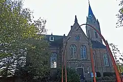 Dutch Reformed church | |
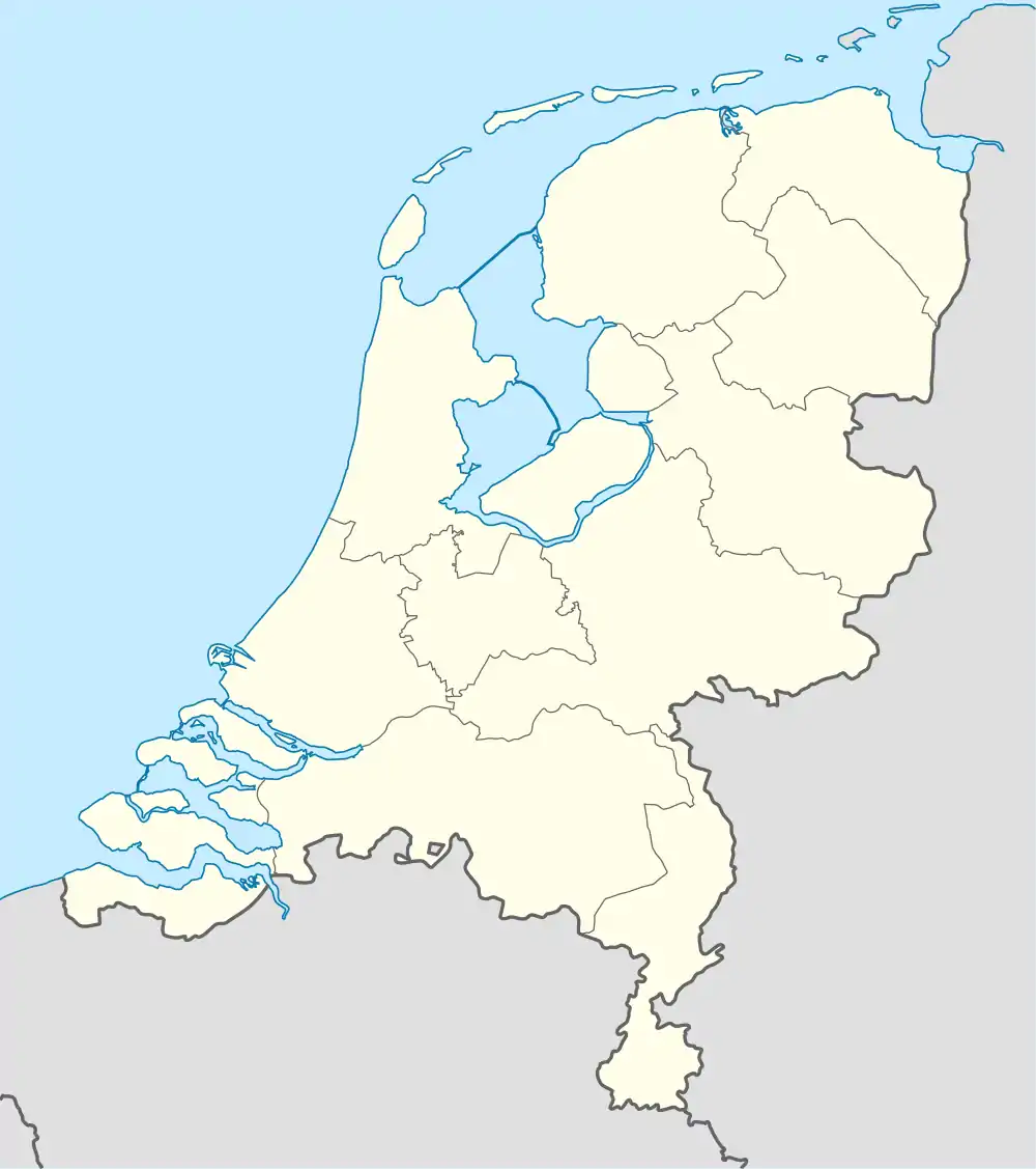 Berkhout Location in the Netherlands 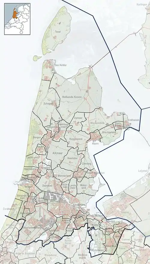 Berkhout Location in the province of North Holland in the Netherlands | |
| Coordinates: 52°38′31″N 4°59′49″E / 52.64194°N 4.99694°E | |
| Country | Netherlands |
| Province | North Holland |
| Municipality | Koggenland |
| Area | |
| • Total | 18.33 km2 (7.08 sq mi) |
| Elevation | −2.3 m (−7.5 ft) |
| Population (2021)[1] | |
| • Total | 2,605 |
| • Density | 140/km2 (370/sq mi) |
| Time zone | UTC+1 (CET) |
| • Summer (DST) | UTC+2 (CEST) |
| Postal code | 1647[1] |
| Dialing code | 0229 |
Berkhout is a village in the northwest Netherlands. It is in the municipality of Koggenland, North Holland, about 5 km (3 mi) west of Hoorn.
History
The village was first mentioned around 1312 as Berchout, and means "deciduous forest of birch (Betula) trees".[3] Berkhout developed in the 13th century as a peat excavation village.[4]
The Dutch Reformed church is a T-shaped church in Renaissance Revival style built in 1884. The tower was added in 1886.[4]
Berkhout was home to 766 people in 1840. It was an independent municipality until 1979 when it was merged into Wester-Koggenland. In 2007, it became part of the municipality of Koggenland.[5]
Notable people
- Henk Jonker, photographer (1912–2002)
Gallery
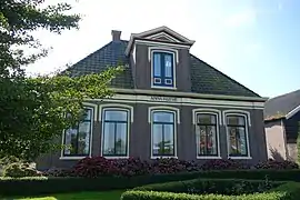 Farm Anna Hoeve
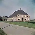 Farm in Berkhout
Climate
| Climate data for Berkhout (1991−2020 normals, extremes 1999−present) | |||||||||||||
|---|---|---|---|---|---|---|---|---|---|---|---|---|---|
| Month | Jan | Feb | Mar | Apr | May | Jun | Jul | Aug | Sep | Oct | Nov | Dec | Year |
| Record high °C (°F) | 13.6 (56.5) |
18.0 (64.4) |
22.3 (72.1) |
27.1 (80.8) |
29.8 (85.6) |
32.5 (90.5) |
35.7 (96.3) |
33.0 (91.4) |
29.7 (85.5) |
25.0 (77.0) |
19.1 (66.4) |
14.4 (57.9) |
35.7 (96.3) |
| Mean daily maximum °C (°F) | 5.9 (42.6) |
6.5 (43.7) |
9.5 (49.1) |
13.7 (56.7) |
17.3 (63.1) |
19.7 (67.5) |
22.0 (71.6) |
21.9 (71.4) |
18.8 (65.8) |
14.4 (57.9) |
9.7 (49.5) |
6.7 (44.1) |
13.8 (56.8) |
| Daily mean °C (°F) | 3.6 (38.5) |
3.7 (38.7) |
6.0 (42.8) |
9.1 (48.4) |
12.8 (55.0) |
15.4 (59.7) |
17.7 (63.9) |
17.6 (63.7) |
14.7 (58.5) |
11.0 (51.8) |
7.2 (45.0) |
4.4 (39.9) |
10.3 (50.5) |
| Mean daily minimum °C (°F) | 1.1 (34.0) |
0.9 (33.6) |
2.4 (36.3) |
4.5 (40.1) |
8.0 (46.4) |
10.8 (51.4) |
13.1 (55.6) |
13.0 (55.4) |
10.6 (51.1) |
7.6 (45.7) |
4.4 (39.9) |
1.8 (35.2) |
6.5 (43.7) |
| Record low °C (°F) | −15.4 (4.3) |
−21.9 (−7.4) |
−18.7 (−1.7) |
−6.5 (20.3) |
−1.7 (28.9) |
3.5 (38.3) |
6.7 (44.1) |
6.3 (43.3) |
2.9 (37.2) |
−4.4 (24.1) |
−6.7 (19.9) |
−10.0 (14.0) |
−21.9 (−7.4) |
| Average precipitation mm (inches) | 73.3 (2.89) |
61.1 (2.41) |
51.8 (2.04) |
41.3 (1.63) |
52.3 (2.06) |
58.3 (2.30) |
73.5 (2.89) |
98.1 (3.86) |
84.8 (3.34) |
98.6 (3.88) |
84.6 (3.33) |
86.5 (3.41) |
864.2 (34.02) |
| Average relative humidity (%) | 88.3 | 86.6 | 83.3 | 79.7 | 78.2 | 79.6 | 79.6 | 81.4 | 84.6 | 86.5 | 89.5 | 89.6 | 83.9 |
| Mean monthly sunshine hours | 69.4 | 95.3 | 153.1 | 209.9 | 236.6 | 218.8 | 233.6 | 205.5 | 155.5 | 120.7 | 68.0 | 59.1 | 1,825.5 |
| Percent possible sunshine | 27.1 | 33.9 | 41.5 | 49.5 | 48.5 | 43.5 | 46.2 | 45.0 | 40.8 | 36.5 | 25.7 | 24.7 | 38.6 |
| Source: Royal Netherlands Meteorological Institute[6][7] | |||||||||||||
References
- 1 2 3 "Kerncijfers wijken en buurten 2021". Central Bureau of Statistics. Retrieved 30 April 2022.
- ↑ "Postcodetool for 1647AA". Actueel Hoogtebestand Nederland (in Dutch). Het Waterschapshuis. Retrieved 30 April 2022.
- ↑ "Berkhout - (geografische naam)". Etymologiebank (in Dutch). Retrieved 30 April 2022.
- 1 2 Ronald Stenvert & Saskia van Ginkel-Meester (2006). "Berkhout" (in Dutch). Zwolle: Waanders. Retrieved 29 April 2022.
- ↑ "Berkhout". Plaatsengids (in Dutch). Retrieved 30 April 2022.
- ↑ "Weerstatistieken Berkhout". Royal Netherlands Meteorological Institute. Retrieved 24 June 2022.
- ↑ "Klimaatviewer 1991-2020". Royal Netherlands Meteorological Institute. Retrieved 24 June 2022.
This article is issued from Wikipedia. The text is licensed under Creative Commons - Attribution - Sharealike. Additional terms may apply for the media files.