Barisal Sadar
বরিশাল সদর | |
|---|---|
.svg.png.webp) | |
| Coordinates: 22°42′N 90°22′E / 22.700°N 90.367°E | |
| Country | |
| Division | Barisal Division |
| District | Barisal District |
| Headquarters | Barisal |
| Area | |
| • Total | 324.40 km2 (125.25 sq mi) |
| Population (2011) | |
| • Total | 527,017 |
| • Density | 1,600/km2 (4,200/sq mi) |
| Time zone | UTC+6 (BST) |
| Website | Official Map of the Barisal Sadar Upazila |
Barisal Sadar (Bengali: বরিশাল সদর) is an upazila of Barisal District in the division of Barisal, Bangladesh.[1]
Geography
Barisal Sadar is located at 22°42′00″N 90°22′00″E / 22.7000°N 90.3667°E. It has a total area of 324.41 km2.[2]
Demographics
| Year | Pop. (000) | ±% |
|---|---|---|
| 1981 | 513 | — |
| 1991 | 616 | +20.1% |
| 2001 | 724 | +17.5% |
| 2011 | 527 | −27.2% |
| Source: Bangladesh Bureau of Statistics[3] | ||
According to the 2011 Bangladesh census, Barisal Sadar Upazila had 114,774 households and a population of 527,017. 104,310 (19.79%) were under 10 years of age. Barisal had a literacy rate (age 7 and over) was 69.35%, compared to the national average of 51.8%, and a sex ratio of 974 females per 1000 males. 339,308 (64.38%) lived in urban areas.[5][4]
Administration
Barisal Sadar Upazila is divided into ten union parishads: Chandpura, Chandramohan, Char Baria, Char Kowa, Char Monai, Jagua, Kashipur, Roypasha-Karapur, Shayestabad, and Tungibaria. The union parishads are subdivided into 105 mauzas and 110 villages.[3]
Notable people
- Hayat Mahmud, feudal lord, commander and founder of Miah Bari Mosque
- Syed Faizul Karim, Islamic scholar and politician
- Syed Fazlul Karim, founder of Islami Andolan Bangladesh
- Syed Rezaul Karim, incumbent Pir of Char Monai
See also
References
- ↑ Ushasi Eashika Khan (2012). "Barisal Sadar Upazila". In Sirajul Islam and Ahmed A. Jamal (ed.). Banglapedia: National Encyclopedia of Bangladesh (Second ed.). Asiatic Society of Bangladesh.
- ↑ "Bangladesh Bureau of Statistics Region Census 2011 page 17" (PDF). Bangladesh Bureau of Statistics. Archived from the original (PDF) on 2015-09-23. Retrieved 2014-09-20.
- 1 2 "District Statistics 2011: Barisal" (PDF). Bangladesh Bureau of Statistics. Archived from the original (PDF) on 13 November 2014. Retrieved 14 July 2014.
- 1 2 "Bangladesh Population & Housing Census-2011, Zila Report: Barisal" (PDF). Bangladesh Bureau of Statistics. p. 18.
- ↑ "Community Report: Barisal" (PDF). Population & Housing Census 2011. Bangladesh Bureau of Statistics. Retrieved 15 August 2018.
Cities, towns and locations in Barisal District | |||||||||||||||||||||
|---|---|---|---|---|---|---|---|---|---|---|---|---|---|---|---|---|---|---|---|---|---|
| Cities, municipal and towns |
| ||||||||||||||||||||
| Neighbourhoods and localities |
| ||||||||||||||||||||
| See also |
| ||||||||||||||||||||
Capital: Barisal | ||
| Barguna District | 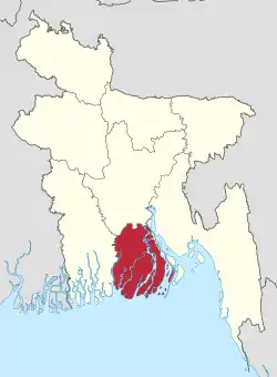 | |
| Barisal District | ||
| Bhola District | ||
| Jhalokati District | ||
| Patuakhali District | ||
| Pirojpur District | ||