Ban Mung
บ้านมุง | |
|---|---|
Subdistrict | |
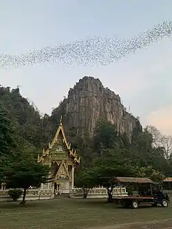 Daily bat flight of Ban Mung | |
| Coordinates: 16°34′00″N 100°42′00″E / 16.56667°N 100.70000°E | |
| Country | Thailand |
| Province | Phitsanulok |
| District | Noen Maprang |
| Population (2005) | |
| • Total | 6,944 |
| Time zone | UTC+7 (ICT) |
| Postal code | 65190 |
| Geocode | 650902 |
Ban Mung (Thai: บ้านมุง) is a subdistrict in the Noen Maprang District of Phitsanulok Province, Thailand.
Geography
The subdistrict lies within the Nan Basin, which is part of the Chao Phraya Watershed.
Administration
The following is a list of the subdistrict's mubans, which roughly correspond to villages:[1]
| No. | English | Thai |
| 1 | Ban Mung Nuea (North Ban Mung) | บ้านมุงเหนือ |
| 2 | Ban Mung Thai (South Ban Mung) | บ้านมุงใต้ |
| 3 | Ban Mai Samakkee | บ้านใหม่สามัคคี |
| 4 | Ban La Phat | บ้านลำพาด |
| 5 | Ban Huai Bo Thong | บ้านห้วยบ่อทอง |
| 6 | Ban Hua Kao | บ้านหัวเขา |
| 7 | Ban Noen Suang | บ้านเนินสว่าง |
| 8 | Ban Thung Phra | บ้านทุ่งพระ |
References
- ↑ Pitlocal.org (in Thai)
This article is issued from Wikipedia. The text is licensed under Creative Commons - Attribution - Sharealike. Additional terms may apply for the media files.