Ballots | |
|---|---|
 Coat of arms | |
Location of Ballots | |
 Ballots 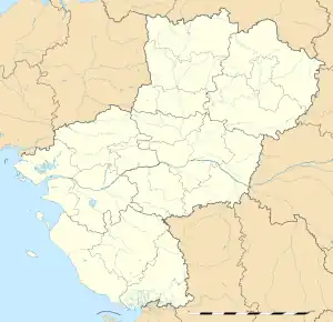 Ballots | |
| Coordinates: 47°53′45″N 1°02′45″W / 47.8958°N 1.0458°W | |
| Country | France |
| Region | Pays de la Loire |
| Department | Mayenne |
| Arrondissement | Château-Gontier |
| Canton | Cossé-le-Vivien |
| Government | |
| • Mayor (2020–2026) | François Quargnul[1] |
| Area 1 | 36.01 km2 (13.90 sq mi) |
| Population | 1,317 |
| • Density | 37/km2 (95/sq mi) |
| Time zone | UTC+01:00 (CET) |
| • Summer (DST) | UTC+02:00 (CEST) |
| INSEE/Postal code | 53018 /53350 |
| Elevation | 48–93 m (157–305 ft) (avg. 96 m or 315 ft) |
| 1 French Land Register data, which excludes lakes, ponds, glaciers > 1 km2 (0.386 sq mi or 247 acres) and river estuaries. | |
Ballots (French pronunciation: [balo]) is a commune in the Mayenne department in northwestern France.
Population
| Year | Pop. | ±% p.a. |
|---|---|---|
| 1968 | 1,242 | — |
| 1975 | 1,129 | −1.35% |
| 1982 | 1,092 | −0.47% |
| 1990 | 1,049 | −0.50% |
| 1999 | 1,036 | −0.14% |
| 2009 | 1,244 | +1.85% |
| 2014 | 1,269 | +0.40% |
| 2020 | 1,305 | +0.47% |
| Source: INSEE[3] | ||
See also
References
- ↑ "Répertoire national des élus: les maires". data.gouv.fr, Plateforme ouverte des données publiques françaises (in French). 2 December 2020.
- ↑ "Populations légales 2021". The National Institute of Statistics and Economic Studies. 28 December 2023.
- ↑ Population en historique depuis 1968, INSEE
Wikimedia Commons has media related to Ballots (Mayenne).
This article is issued from Wikipedia. The text is licensed under Creative Commons - Attribution - Sharealike. Additional terms may apply for the media files.