Artenay | |
|---|---|
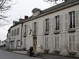 Town hall | |
 Coat of arms | |
Location of Artenay | |
 Artenay 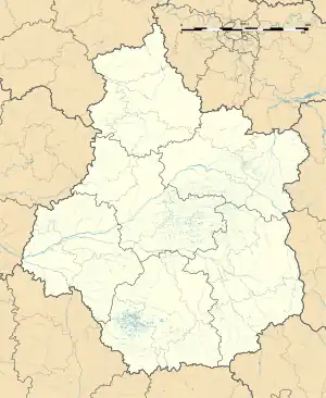 Artenay | |
| Coordinates: 48°04′59″N 1°52′45″E / 48.0831°N 1.8792°E | |
| Country | France |
| Region | Centre-Val de Loire |
| Department | Loiret |
| Arrondissement | Orléans |
| Canton | Meung-sur-Loire |
| Intercommunality | CC Beauce Loirétaine |
| Government | |
| • Mayor (2020–2026) | David Jacquet[1] |
| Area 1 | 20.5 km2 (7.9 sq mi) |
| Population | 1,983 |
| • Density | 97/km2 (250/sq mi) |
| Time zone | UTC+01:00 (CET) |
| • Summer (DST) | UTC+02:00 (CEST) |
| INSEE/Postal code | 45008 /45410 |
| Elevation | 117–129 m (384–423 ft) |
| 1 French Land Register data, which excludes lakes, ponds, glaciers > 1 km2 (0.386 sq mi or 247 acres) and river estuaries. | |
Artenay (French pronunciation: [aʁtənɛ]) is a commune in the Loiret department, north-central France. Artenay station has rail connections to Orléans, Étampes and Paris.
Population
| Year | Pop. | ±% p.a. |
|---|---|---|
| 1968 | 1,514 | — |
| 1975 | 1,589 | +0.69% |
| 1982 | 1,939 | +2.88% |
| 1990 | 2,008 | +0.44% |
| 1999 | 1,945 | −0.35% |
| 2009 | 1,828 | −0.62% |
| 2014 | 1,820 | −0.09% |
| 2020 | 1,969 | +1.32% |
| Source: INSEE[3] | ||
See also
References
- ↑ "Répertoire national des élus: les maires". data.gouv.fr, Plateforme ouverte des données publiques françaises (in French). 9 August 2021.
- ↑ "Populations légales 2021". The National Institute of Statistics and Economic Studies. 28 December 2023.
- ↑ Population en historique depuis 1968, INSEE
Wikimedia Commons has media related to Artenay.
This article is issued from Wikipedia. The text is licensed under Creative Commons - Attribution - Sharealike. Additional terms may apply for the media files.