Ambolomoty | |
|---|---|
 Ambolomoty Location in Madagascar | |
| Coordinates: 16°10′S 46°42′E / 16.167°S 46.700°E | |
| Country | |
| Region | Boeny |
| District | Marovoay |
| Area | |
| • Total | 50.92 km2 (19.66 sq mi) |
| Elevation | 11 m (36 ft) |
| Population (2001)[3] | |
| • Total | 12,000 |
| Time zone | UTC3 (EAT) |
| Postal code | 416 |
Ambolomoty is a rural municipality in Madagascar. It belongs to the district of Marovoay, which is a part of Boeny Region. It is situated at a distance of 99 km from Mahajanga at the National road 8. The population of the commune was estimated to be approximately 12,000 in 2001 commune census.[3]
Primary and junior level secondary education are available in town. The majority 60% of the population of the commune are farmers, while an additional 38% receives their livelihood from raising livestock. The most important crop is rice, while other important products are maize and cassava. Industry and services provide both employment for 1% of the population.[3]
References
- ↑ COMMUNE RURALE D’AMBOLOMOTY SCHEMA D’AMENAGEMENT COMMUNAL
- ↑ Estimated based on DEM data from Shuttle Radar Topography Mission
- 1 2 3 "ILO census data". Cornell University. 2002. Retrieved 2008-03-02.
Capital: Mahajanga | ||
| Ambato-Boeni (11) (403) | 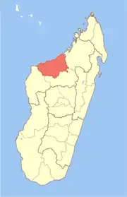 | |
| Mahajanga (1) | ||
| Mahajanga II (9) (402) | ||
| Marovoay (12) (416) | ||
| Mitsinjo (7) (417) | ||
| Soalala (3) (420) | ||
6 districts; 43 communes | ||
16°10′S 46°42′E / 16.167°S 46.700°E
This article is issued from Wikipedia. The text is licensed under Creative Commons - Attribution - Sharealike. Additional terms may apply for the media files.